2013-10-10 48 9
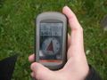
| Thu 10 Oct 2013 in 48,9: 48.9356785, 9.6211037 geohashing.info google osm bing/os kml crox |
Location
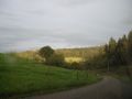
The meeting point was on a field of grass outside the tiny village of Weidenhof
Participants
Plans
The location looked easy enough, so just showing up and figuring it out seemed ok. For a lack of time the car was the preferred means of travel. I know it's not the most exciting place, but this being my first and yesterday's point was so close, but unreachable, I had to go to this one.
Expedition
As expected the journey was not difficult. But it took me way in the backlands (for german standards) of the area. Tiny roads, hardly any traffic or people. Lots of dark forrest and the occasional cow. Right at the meeting place I was only noticed by some cows whose gazes followed my every move. They were in the next field so we did not get too close. It had rained recently so the grass was wet, but otherwise the weather was ok. Afterwards, the sun even showed up for a second or two. On the way back I realised that the meeting point was very close to the Ebnisee, a popular place in summer for swimnming and hanging out.
Tracklog
Photos
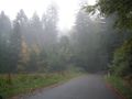
the way there
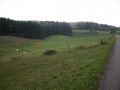
where it all went down
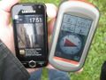
date and location
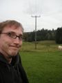
me
can be exact, too
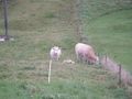
she was watching
yupp, it was there
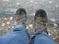
the grass did that to me
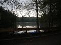
a lot more fun in summer


Achievements
Hmpf earned the Land geohash achievement
|
Hmpf earned the Last man standing achievement
|