2013-10-26 47 11

| Sat 26 Oct 2013 in 47,11: 47.2990923, 11.1690498 geohashing.info google osm bing/os kml crox |

Location
Inntal above Pettnau, 1100m altitude, 50m off from a hiking trail.
Participants
- EleanorAbernathy
- LeslieHapablap (previous|next)
- Waltraud the hashkiwi
Plans
Leave Innsbruck at about 11am, bike to Tiefental and walk 3.4 km uphill to the hashpoint. We are aiming for an official Saturday meetup (1pm).
Expedition

- Made it! Nice place. -- LeslieHapablap (talk) @47.2990,11.1689 13:09, 26 October 2013 (CEST)
It is the national holiday today in Austria (October 26, 1955: Declaration of Neutrality), and the weather was totally up to it. A clear and pleasantly warm October day, only slightly overcast. Going on this expedition felt like rounding off the geohashing season for this year, which has started with some nice cycling tours in early summer, also because the cycling route today was exactly part of the Garmisch tour in May.

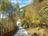
We set off shortly past 11am, and after a few minutes I turned back and went home again to fetch our bike locks (and a bottle of water which I also forgot before as it turned out). Meanwhile EleanorAbernathy waited at a spot with perfect view on the Innsbruck airport with an ongoing Air Show. After that we drove for about 45 minutes along the B171 to Pettnau, where we locked up the bikes and changed into walking shoes. From there it was about one hour walking uphill on convenient forest roads almost right up to the hashpoint. With mountain bikes it would have been no problem to make all the way to the coordinates, but for our racing bikes it was a no go where the asphalt roads ended.
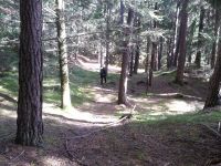
We came along some beautiful trees with bright red and yellow leafs. As soon as we were high enough and out of direct line of sight of the Inn-valley freeway, which constantly adds to the noise level, it was completely silent. The hashpoint itself was very easy to reach, the terrain was not steep with sparsely scattered trees and soft mossy ground. It was exactly 1pm when we arrived, we marked a tree with the "xkcd" sign, took some photos of the place and went back the same way we came up. On our way down we saw and heard two birds, which we first mistook for crows. But as they flew away we could see that they were huge, and later at home we listened to some vocalization samples and are pretty sure they were ravens (Common Raven, "Kolkrabe" in German). Unfortunately we couldn't take pictures.
Cycling back to Innsbruck slightly downhill along the flow of the river Inn was a little bit easier than going the other way. We enjoyed the rest of the tour and finally arrived home, where we were greeted by our friendly neighbors (a few sheep on a meadow next to our house).
Tracklog
Photos
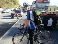
Find the sheep in this picture! (No it's not on the bike, silly you)
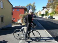
Again, find the sheep in this picture. (This time might be on a bike)
Innsbruck airport.

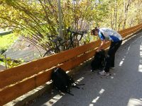
Our bikes had to wait.
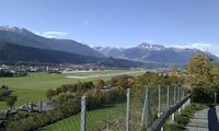
Autumn in Tirol.
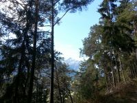
Snow on the mountain tops.
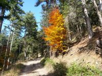
A tree in flames.
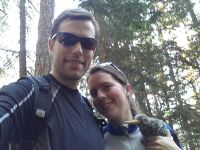
Obligatory goofy grin, with Waltraud the hashkiwi.
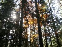
Autumn at the hash point.
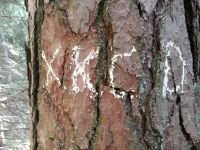
Our marker.
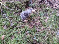
Waltraud in her natural habitat: on the ground.
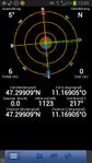
Obligatory proof.
Going back, near the coordinates.
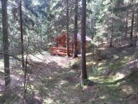
A small cottage near the coordinates.
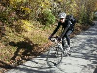
Preparing for cycling home.
On the way back.
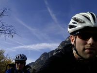
Blue skies on the national holiday.

Our neighbors.


Achievements
EleanorAbernathy and LeslieHapablap earned the Land geohash achievement
|
EleanorAbernathy and LeslieHapablap earned the Bicycle geohash achievement
|
EleanorAbernathy and LeslieHapablap earned the Neutrality achievement
|