2013-10-27 47 13
| Sun 27 Oct 2013 in 47,13: 47.7883884, 13.0978016 geohashing.info google osm bing/os kml crox |
Contents
[hide]Expedition Report: DST Timetravel Pt.1
This is part one of a two part series describing an attempt to perform the DST Timetravel multihash achievement. For part two please take a look over here.
Location
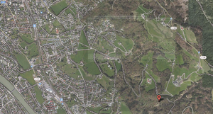
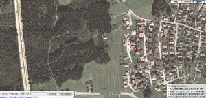
About 10km into the outskirts of Salzburg, pretty much at the end of a one way road on top of a hill. The hashpoint was ~3 minutes away from the road, down the hill into the woods. If it was 50m to the south we wouldn't had a chance to reach it, as a steep flank of the hill was cutting off the way.
Participants
Plans
B2c, although not the most active of geohashers, had set his mind on the timetraveller achievement for a long time. Although the next timezone was literally thousands of klicks away one option still remained: daylight saving time. (This feat had been discussed on the Geohash Wiki on the Time-Traveller talk page, but no one has ever managed to pull it off.) Once per year the clocks would be turned back one hour (at 03:00h back to 02:00h) and one would be presented with the chance to travel through space and time. A couple month ago B2c talked about the endavour to Patrizius who immediately joined in on the madness. Since then they were lying in wait for the day to come.
As the hashpoints were calculated randomly there was no point in checking the hashpoints of previous DST clock changes (most of them were impossible to get, just for the record), so they started to monitor hash point distribution and possible routes. They soon realized that the two hashpoints had to fall within striking distance to a nearby motorway to make it in time. An east-to-west motorway at that, which only left them with two options: the A1 from Vienna to Salzburg or a section of the A2 in Carinthia, with the second one being a risky option as the surrounding terrain isn't very geohash-friendly. They knew that the hash location would be available on Fri, 2013-10-25 around 15:30h local time, which would leave them with about two days to plan accordingly, IF the hash-RNG-goddess would bless them. So B2c impatiently waited for the minutes to tick away on said friday to check the weekend coordinates. When they finally popped up on the Geohash Droid App's screen his hopes were pretty much immediately squashed. The hashes around Europe/Vienna were pretty much in the middle of nowhere and the Carinthia hashes were out of question too... so another year of waiting?
As he was sitting in the pub, chewing on his schnitzel and browsing the map mindlessly he stumbled upon the Salzburg and Rosenheim graticules which he hadn't been focusing on and which had been pretty much ruled out before. But the hashpoints looked promising, only being 5-10km away from the motorway - a section of the german A8 motorway. On the off chance that the hashes would be reachable in one hour he started researching the graticules.
Now most people think of the german autobahn as something like a giant runway where one can go as fast as he likes, not having to think about anything like speed limits, turns, speed traps or the laws of physics.
So now we know what this part of the A8 looks like - 80km's of a narrow, winding motorway with shifting speedlimits, lots of traffic and little space to maneuver at high speeds that grinds itself through the lower alps. Way to go...
Interlude - disclosure
thanks@FFOMARIO for uploading the video, so I didn't have to make one myself. Wouldn't have been much of a show in the pitch black night anyway. A part of the section we had to pass is shown in the video between minute ~07:00 and ~27:00, however we passed it in the opposite direction. Probably long enough to give you the idea. The car's speedo isn't visible but you can probably tell that this guy is going pretty fast!
/Interlude
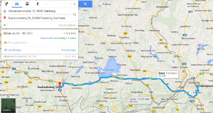
So now B2c's hope was alive again - but was it really possible? As he entered the hash locations into google maps and simultaneously texted Patrizius he stared at the screen - 1h7m. 92km. Just a bit shy of the one hour mark. It had to be possible, he told himself. It would be in the middle of the night. No traffic. Disabled traffic lights. Keep the streets empty for me. What could possibly go wrong? He pushed the send button: "hash detected: salzburg->rosenheim. it's happening...". Some ten kilometers away Patrizius fired up his laptop...
Expedition
Patrizius and B2c met at ~19h on saturday evening in Vienna at a gas station near Patrizius' flat, knowing that the next time they would be standing here would be at least 10 hours from now and they would have travelled more than a thousand kilometers. Patrizius had been prepping his GPS gear, smartphone and camera, planning the route all day, but there still were uncertainties. The satellite images of the hashpoints indicated that both hashpoints were out in the open, but the Salzburg hash was on the slope of a hill, with lots of trees prohibiting clear view of the terrain and making it hard to read. On the Rosenheim front the hash fell into what appeared to be a meadow somewhere in suburbia. The date on the images was from about a year ago, so things could have changed since then.
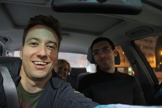
They agreed that, as time was precious and it being in the middle of the night, they had to scout out the hashpoints in advance. They had to know the surroundings, the best way of approach. There was the possibility of construction sites on the motorway, which sometimes only impeded one direction of traffic and thereby possibly could be avoided. Also the non-motorway parts of the way, which made up about 15% of the distance, seemed to be small roads or one-way alleys, where even at night and with low traffic it wouldn't be possible to gain some ground on the google maps prediction of 67mins. On the bright side Patrizius' girlfriend C. surprisingly joined in, bringing home-baked cake and other treats with her, which would sweeten the tour through half of the country (yes, Austria is that small ;). So they went over the checklist for the last time, gassed up the car, bought some caffeinated beverages and drove off to Salzburg.
Gear
- Canon EOS 60D
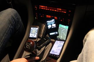
- 2x Garmin GPS (details to come)
- Samsung Galaxy S2
- HTC Desire
- LG Google Nexus 4
- C.'s Smartphone (details to come)
- tons of cake, cookies, juice and coffeine
- the wrong GPS app :(
Scouting Salzburg
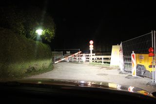
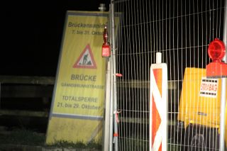
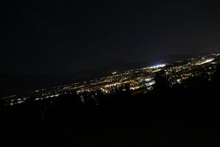
Fast-Forward: after approximately three hours of boring motorway they arrived at Salzburg, immediately making their way through the outskirts of the town towards the hashpoint. At that point everyone in the car was suspense-packed; what would the site at the hashpoint look like? Would it even be accessible? Would everything have been in vain? But even before they were half way through the town the road which led to the hashpoint was blocked! A construction site at a bridge forced them to take a costly detour, giving everyone the feeling of being off to a bad start. After following some route deviations the BMW slowly crawled up a winding road to the hilltop, which gave way to a beautiful view over Salzburg at night, before entering a forrested area and finally coming to a stop. They had arrived near the first hashpoint!
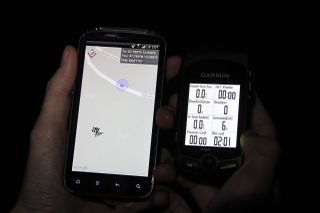
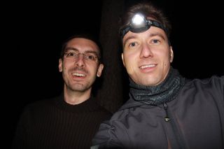
Patrizius and B2c left the car packing torches and GPS' and started to descend down the slope into the woods. After about 5 minutes they reached the hash and waited for the GPS to stabilize - the hashpoint was 'jumping around' like mad and would move for more than 50m. At times it seemed that they would have to take a lengthy walk to the other side of a creek flowing what seemed to be 10-15m below them, but luckily the GPS stabilized and the hashpoint turned out to be easily accessible. Check! They marked the hashpoint and measured the time it would take them to get back to the car. After a short break and some stretching of stiff limbs, off they went to Rosenheim.
Scouting Rosenheim
While driving to Rosenheim for the first time they took notes, partitioned the way in several sections and measured the the time taken for each one. When they would attempt the real time-travel there was pretty much no margin for errors. As they were closing in on Rosenheim and the minutes were ticking away everyone knew that it was going to be a close call. As no one of the three ever had been to Rosenheim it took them a couple of minutes to know their way around. If this had been the real deal they wouldn't have made it, as they were already over the one hour mark before the reached the Rosenheim suburbs - and they were still in for a surprise...
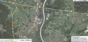
While cruising the suburbs and being on the outlook for the best possible approach to the hash they stopped in front of a couple of nice town houses, with neat gardens and big garages. At that point they had to go on by foot as it wasn't possible to determine the exact location any other way. After roaming around some houses, probably looking like burglars and already attracting neighborhood watch, trying to get a GPS fix on the location that matched the satellite image they realized that there was a little problem: the hash was located in the middle of an estate on the patio between the garage and a garden shed. Behind a fence. With motion detectors and pretty exterior lighting all around. At least there were no guard dogs. But these circumstances would probably require some nifty hit-and-run tactics - or how would you explain to the property owner what you were doing on his patio, in the middle of the night, with torches, smartphones and GPS devices?
Rosenheim - Salzburg - Rosenheim Or: Upping the ante
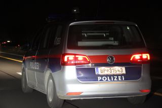
These 'experiences' left the wannabe time travelers a little bit unsettled. They had to be way faster as expected to make it in time. One wrong turn - game over. An encounter with the police - game over too. Taking too long to get out of Salzburg's woods and alleys or getting caught while breaking and entering in Rosenheim? See you next year - if ever. These and other worries where crossing their minds as they where cruising back to Salzburg. But their determination hadn't been broken yet.
After arriving back at Salzburg around midnight they stopped at a 24/7 fuel station to gas up the thirsty bee of a BMW and to discuss their options. After pondering a little about the 'Rosenheim issues' they decided to move ahead with the plan, but with some adjustments. They decided to go from Salzburg to Rosenheim, as the time it took to drive from the Salzburg outskirts to the motorway seemed to be the biggest unknown in their calculations. They had already calculated when they had to be at which 'waypoints' to make it in time to the Rosenheim hash. If they were to miss any of those intermediate goals they could still call it off, lick their wounds and have a very silent and lonely trip back to Vienna. As for the the time being they could do nothing but wait for 02:00h, so they ate some delicious pie, inhaled some coffee and checked their gear for the god-knows-how-often time.
At ~01:50h they packed up and started to make their way out of town, up the narrow road to the marked location on the hill. Everyone could feel the rising tension at this moment, wanted to be at the top of one's game. Patrizius would be the navigator/human satnav, guiding B2c all the way out of Salzburg and later, into the Rosenheim suburbs. C. would be on the stopwatch, checking the timing at the defined waypoints and coordinating with Patrizius. And, well, B2c had to try hard to not steer the car off the road.
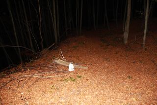
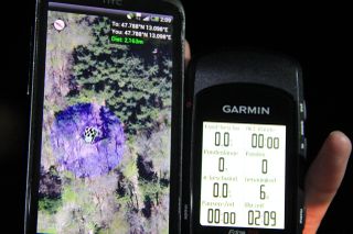
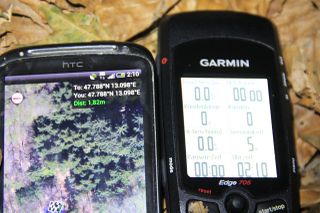
At ~02:02h Patrizius and B2c left the car to venture down the hill to the location of the hashpoint. From down there it would be a steep 3 minute climb/run back to the car. They waited for the GPS fix, took some pictures (at 02:09h and 02:10h, see below) and a deep breath and - started running up the hill. At 02:13h they jumped into the car and started the race against the clock. Would they make it in time? Only time and maybe this page will tell!
Achievements
- Achievement summary is on pt.2 of the expedition report.
Photos
- Photo Gallery
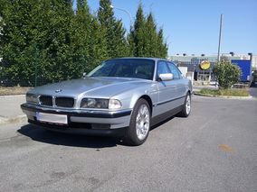
B2c's (t)rusty ride: 95' BMW 740i
