2013-11-09 44 -124
| Sat 9 Nov 2013 in 44,-124: 44.1787627, -124.0892742 geohashing.info google osm bing/os kml crox |
Location
About a kilometer into Siuslaw National Forest, north of Florence, Oregon.
Participants
Plans
Our main ambition for the past couple weeks had been geohashing in one of the two virgin graticules neighboring Eugene, Oregon. When we noticed that this one was both on land and in an obviously public area, we were very excited. We borrowed friend and occasional geohashing partner Greg's truck for the drive down.
Expedition
Getting up bright and early (10:00 am) proved to be difficult, so we left from Frogman's house at around 11:00 am. Blaring tunes, we drove through through the forest on U.S. Numbered Highway 20 to Newport. After arriving there, we headed south.
Our first destination was Cape Perpetua. We drove up to the day use area and took pictures at the magnificent view. At the viewpoint was a map showing the location of the visitor's center, which we decided to check out.
Parking at the visitor's center was free for Veterans' Day weekend! The visitor's center itself was very nice. One wall was a single window, overlooking the ocean. Two people with binoculars were looking for sea lions; apparently a couple had just surfaced nearby! The park ranger was friendly and showed us some maps. We looked at the exhibits; there were whale bones and tree rings to name a few.
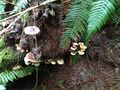
Higgs ended up buying two maps and a book on mushrooms, an interest and common photo subject of his.
The hashpoint itself was a few miles south of Cape Perpetua, and we didn't want to stay out too late, so we left Cape Perpetua without trying any of the hikes. After a turn off of U.S. Numbered Highway 101, we drove up a gravel road to a stream, where we got out and began hiking.
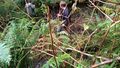
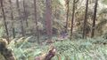
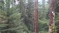
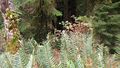
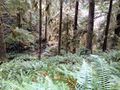
At first we tried to find rather open areas to hike. We walked down the road a bit until we found a nice, mossy uphill that was relatively free of ferns and relatively abundant in photogenic fungi. Soon, however, we found that we would not be able to reach the hashpoint without getting dirty, so we started making our way through the ferns and thickets. We were not as knowledgeable of the topology of the area as would have been useful, so we spent a lot of time going sharply upward or downward on the hills.
After about two hours of blazing a trail through the thick plantlife and plenty of water breaks, we reached the hashpoint. It was on the side of a hill in an area with fewer trees, so the view was nice. The feeling of victory, of course, made it much sweeter.
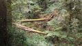
On the way back, we decided to follow the path of a nearby stream instead of going straight over the hills. The horizontal distance traveled was certainly longer, but there were very few ups and downs on this path, so it is likely that the actual distance was much less. It was, however, a very wet and muddy path. We started out concerned for our shoes, but as the accidental slips soaked our socks we stopped caring. I got flashbacks to Michael5000's words of advice when I told of this expedition: "You might need boots."
Eventually we got back to the truck. At this point, the sun was almost setting, so we discarded any plans of doing other hikes and beelined for Mo's in Newport. We ate warm food and then returned home.
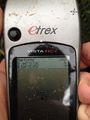
Tracklog
Photos
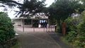
Cape Perpetua vistor center!
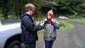
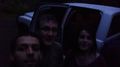
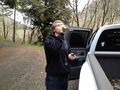
Getting ready for our journey into the wilderness.
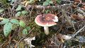
A mushroom!
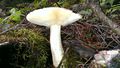
We checked the gills, for identification purposes.
Crossing a stream.
The hills were steep and the brush was thick.
One last valley to cross before the hashpoint!
The view from the hashpoint!
The elevation dropped pretty rapidly near the hashpoint.

Goofy grins.
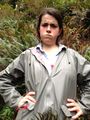
Muddy grins.
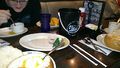
Food at Mo's.
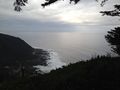
Pretty ocean pictures from Cape Perpetua.
I'm pretty serious about hydration.
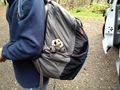
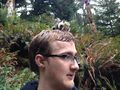
Our guest hashcot for the expedition.
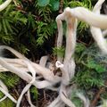
A creepy looking unidentified coral fungus.
Various mushrooms.
Flora.
Sweet victory.
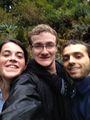
Collard grins.
Poses.
Wet and hashcot.
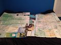
The haul.


Achievements
Frogman, Higgs, Callie earned the Graticule Unlocked Achievement
|
Frogman, Higgs, Callie earned the One with Nature Geohash Achievement
|
AlecS, Frogman, Callie earned the Drowned Rat Geohash Achievement
|