| Sun 8 Dec 2013 in Nogales: 31.8360001, -110.8410924 geohashing.info google osm bing/os kml crox |
| Sat 7 Dec 2013 in Nogales: 31.8493297, -110.8280393 geohashing.info google osm bing/os kml crox |
Location
Off Helvetia Road, north of the Santa Rita Mountains.
Participants
Expeditions
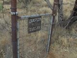
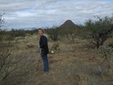
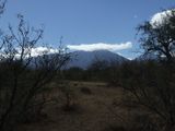
Since the locations for Saturday and Sunday were about 2 miles apart, we initially planned to do a dual midnight geohash where we would hit one point just before midnight and then immediately go to the other point. Two geohashes within 30 minutes or so. Didn't pan out. RoadRunner had a long day on Saturday and bailed on geohashing at midnight, so we did the next best thing ... hit both locations on Sunday morning. Yeah, less "geohash points", but it's never about score. Ended up hitting both points within 25 minutes. I'm sure it would have taken longer trying it in the dark (and not getting up close and personal with the cacti), but it would have been fun and possibly led to a new achievement. Pictures would not have been as scenic.


