2014-01-05 47 -121
| Sun 5 Jan 2014 in Snoqualmie: 47.4007173, -121.4881152 geohashing.info google osm bing/os kml crox |
Location
Off the Pratt Lake trail, along I-5.
Participants
Plans
We had no real plans, actually. It was a spur-of-the-moment decision to try the trail out in Snoqualmie, snow and all.
Expedition
Driving out to Snoqualmie wasn't too difficult, but we didn't have a parking permit when we got to the trailhead. After discovering that we had to go even further up Snoqualmie to the local Forestry / Parks Office, we did so and came back with a permit.
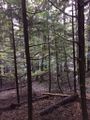
We followed the trail as much as possible, but then it reversed course (to switchback up the mountain). I left the trail and tried cimbing a ways, but my partner got nervous and called me back down. I took shots of the terrain uphill and downhill, as well as recording my furthest progress towards the hashpoint. (Truth be told, it was probably a good idea not to go trying to climb ever-steeper inclines with everything being soggy from snow and melt.)
We continued hiking the trail for a while, though. I took some more pictures before we decided to call it a day.
Tracklog
Photos
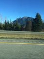
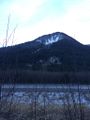
Mountain view #1.
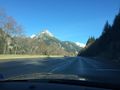
Mountain view #2.
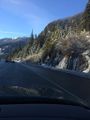
We seem to be gaining altitude...
Definitely getting snowier up here.
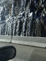
Waterfalls turned to ice.
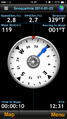
Distance from the hashpoint.
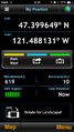
Closest coordinates reached.
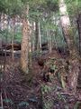
View uphill towards the hashpoint.
View downhill back towards the trail.
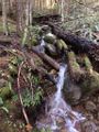
Waterfall along the trail.
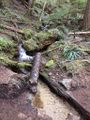
Another waterfall stream.
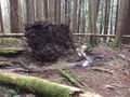
This stream seems to have undermined the tree.
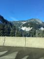
Mountain view #3.


Achievements
Rex earned the Cliffs of Despair consolation prize
|