2014-02-23 44 -123
| Sun 23 Feb 2014 in 44,-123: 44.5180912, -123.5579196 geohashing.info google osm bing/os kml crox |
Location
Near a hiking trail on Mary's Peak.
Participants
Plans
Head over to Mary's Peak, hike a bit, geocache a bit, geohash a bit.
Expedition
The earliest that we were able to leave was 3:30, so we hoped that enough light was left to get some hiking in as well as the geohashing. AlecS downloaded a couple of geocaches onto his GPS so that we had some alternate destinations at hand.
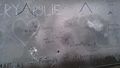
The road to Mary's Peak was full of twists and turns. We were surprised to see a good layer of snow on the ground once we got close to the summit! We stopped in a parking lot and shivered as we tried to decipher a surprisingly unhelpful trail map. Finally, we got ourselves oriented and headed down a trail away from the peak.
Once we entered the trees the wind chill dropped and we were more comfortable. The trail descended past the point at which snow remained. Before we left the trail to blaze a new one to the hashpoint, we found the Lucky 13 hashpoint. I donated a punch-card for a gelato place in Troutdale, Oregon with a single punch on it.
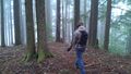
Leaving the trail to head towards the hashpoint, we were soon met with a rather steep downhill. It did not take us long to reach the hashpoint. Overall it was fairly unremarkable, but hey, it's the journey that counts, right?
Tracklog
Photos
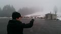
Look at this snowy peak!
Thanks to Friends of Albany for this informative map.
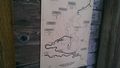
A trail map!
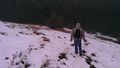
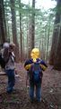
After deciphering the trail map we found a trail.
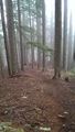
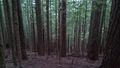
There wasn't any snow after a while.
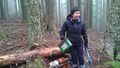
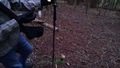
Geocaching sidequest!
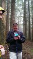
Alison found the cache under rotting wood.
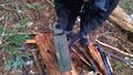
It was an ammo box!

In it was a giraffe.
We signed in on the geocaching log.

Marie, delighted to find the geocache.
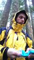
Greg signing in.
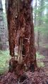
A neat tree near the hashpoint.
Here we are, at the hashpoint!
The view from the hashpoint.
This pole marks about exactly where the hashpoint was, from our reckoning.

Proof!

Grins!

Celebratory posing.

Greg is happy


Pictures in the morning.
Achievements
Frogman, AlecS, Greg, and Alison earned the Drag-along achievement
|