2014-03-04 67 24
| Tue 4 Mar 2014 in 67,24: 67.5441660, 24.0551512 geohashing.info google osm bing/os kml crox |
Location
In Kolari. The hashpoint is in a forest near the swamp of Pikku Kentänvuoma, on the slopes of Malmivaara, near Luosu.
Participants
- Tilley
- Mrs. Tilley
Expedition

Me and my family were on a winter vacation in Ylläs for a week. Very fortunately a hashpoint appeared near skiing tracks, about 8 km south from our place of stay. Along the skiing routes the distance would be about 10 km one way and there would be about 500 meters stretch of untouched snow. Snow depth is 66 cm.
Me and Mrs. Tilley were going to try the expedition to the hashpoint in the morning. We had plans to go skiing an easy route in the afternoon with our whole extended family, including our daughter, Pastori and The Wife. This trip would start at the naptime, about 12:30, before which we would have to eat lunch. Furthermore, our skis were being serviced and we would get them from the service shop not earlier than 9:00. Thus we had only about 2,5 hours time-window to do the hash-expedition.

In the morning, the weather was cloudy but not too cold, about -3°C.After getting the skis from the shop about 9:15 we immediately started towards south. We took a shortcut along a sidewalk to reach the nearest proper ski track. Then it was time to put some power to the poles. The track was freshly maintained, and our newly serviced skis glided really well. On the first 5 km our average speed was 13 km/h. We had hardly time to stop on the 10 km journey there but to sip some water.
Quickly we were nearing the hashpoint, and started to look for directions. When the skiing track was closest to the hashpoint, we stopped, drank some water and ate bananas and some chocolate to brace ourselves to enter the untouched snow. The viability of traversing 1000 meters in the 2/3 meters thick snow in a reasonable time would depend entirely of how well the snow would support our narrow skating-style skis. We held our breath and stepped into the snow. The skis sunk only few centimeters! Very nice. Unfortunately, our poles had almost nonexistent snow rings, so they sunk about 50 cm. So the going was still quite slow. We even made a little detour when we tried to approach the hashpoint from the roadbed northwards from it, only to be thwarted by a too steep slope for us to be able to climb in our skis.

Finally we found the right vector to make it all the way to the hashpoint. It was in a small-grown forest near a swamp. The snowy landscape was very still. There was no sign of any animal life, which in these latitudes is during the winter either hibernating or mostly spending their time under the snow. Quickly we took some pictures and started our return journey along our own tracks.
After reaching the skiing track we again refreshed ourselves and turned towards our place of stay with full throttle. Our energy started to fade a bit, but average on the whole 21 km stretch was about 10,5 km/h, which included the 3 km/h deep snow going. At 11:26 the expedition was complete.
Additional photos
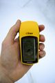
A picture of the coordinates.

Our marker on the snow.

We were overjoyed to reach the hashpoint!


Achievements
Tilley and Mrs. Tilley earned the cross-country skiing achievement
|
Tilley and Mrs. Tilley earned the Frozen Geohash Achievement
|
World's northernmost visited hashpoint so far this year?