2014-06-07 49 12
| Sat 7 Jun 2014 in 49,12: 49.2163560, 12.6759570 geohashing.info google osm bing/os kml crox |
Contents
[hide]Location
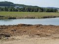
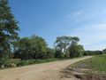
Cham, at a former gravel mining pit which is filled up again.
Participants
Expedition
I had the chance to join a group and go on a daytrip for "almost free" - provided I accept that it will start at Weiden (Oberpfalz) because that's where the others would go. Well, that's not the worst of all restrictions, is it? So I packed my bike and about a quarter past five in the morning, went to the station. About 100 seconds before scheduled departure, the others (who had the ticket) came into sight, and about half a minute before departure we all were on the train and started. We were lucky to be able to find some bike space on all trains (others who wanted to enter the train later weren't so lucky), and arrived at Weiden as planned. There the group parted, and I had to decide what to do with the day.
I finally decided to get off at Nabburg and go for the hash at Cham. I mostly followed the Schwarzach valley trail, which partly uses former railway lines. Along the route I crossed an remarkable bridge and a very village named Schwarzeneck = black corner, which belongs to the municipality of Schwarzhofen = black court, and lies in the valley of the Schwarzach = black water - can it get more black? Followed by a "new castle" located in a town named "new castle". And then there was that large artificial lake which had drowned the old railway line, but nobody ever cared about building another viable cycle trail. Following the signs actually was a bad decision. As soon as the route went along the lake, it got crazily bad: loose gravel, grass, roots, steep slopes continuously going up and down. Then the worst place: At an estimated 20-30% downwards slope the tires or shoes got no hold, just slipping on loose small gravel, in a narrow corner where slipping off the way would mean to fall down into bottomness. They put up a sign with the recommendation that "untrained bikers should get off the bike". Well, my recommendation would be that all bikers try a totally different way. This might be nicer landscape, but IMHO they really should give people a choice and put up a double set of signs. When there was a chance to leave this way and change to the main road, I did. So I have no idea whether it got better or worse afterwards.
When I reached Rötz, I found that I was quite behind my timeline, especially if taking into account that I had to leave the valley here and go over the hills to get to Cham. However I made it. So I reached Cham about an hour before the last train would leave, time enough to go to the hash as planned.
My primary concern about the hash was that it might be inaccessible. According to the sources I had found online, it was supposed to be at the entrance to a gravel mining pit. Inside or outside, was the question. When I got there, it was much better, actually: No barriers, no signs. The pit itself mostly filled up with debris and earth, being recultivated into a meadow. Just one hidden sign which looked like it had been forgotten. The time when this was an active mining pit are gone.
Found the actual hashpoint at the shore of the last remains of the pit - a lake - and went back into town. Got some food, went to the station, jumped on the train, and went back home.
Another graticule conquered!
Gallery
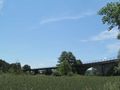
Old railway bridge of Wölsendorf: Four segments in different building techniques
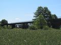
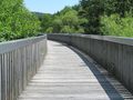
Another bridge
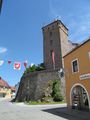
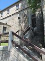
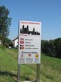
The new castle at Neunburg (which means: New castle).

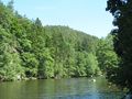
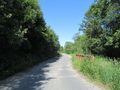
Along lakes...
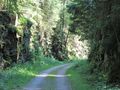
... through canyons ...
... along more lakes ...
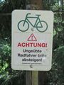
Untrained cyclists please get off the bike. Recommends the tourism administration.
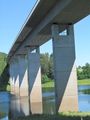
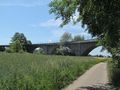
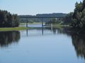
More bridges
reaching Cham
No fence, open gate. Hooray!
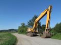
Raptor guarding the hash
The hashpoint
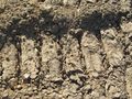
Closeup
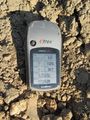
Goordinates
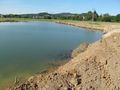
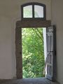
View from hash
View from hash

View from hash

No trespassing into the gravel pit (as if anyone would care... is there still a gravel pit anyway?)

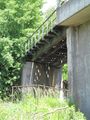
Another bridge to cross
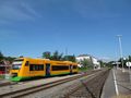
A train of this kind would take me away from Cham.


