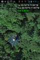
2014-06-24 43 -71

| Tue 24 Jun 2014 in 43,-71: 43.7469551, -71.5966771 geohashing.info google osm bing/os kml crox |
Location
In the forest west of Squam Lake, Holderness, New Hampshire, USA
Participants
Expedition
Big surprise: the Concord, NH graticule, just north of the Origin of Geohashing, appears to still be virgin! And here we are.
G. had laid out instructions for two different road approaches. The first, approaching from the northwest, looked like it would let us drive within just over half a mile and then walk most of the way along woods roads before we began to bushwhack. Unfortunately the last turn we needed was onto a road marked "Private". We therefore shifted to plan B.
Plan B, approaching from the southeast, looked like a half-mile uphill bushwack from the end of a road. Unfortunately the name on the road sign was different from the name on the map (and, as it turned out later, this road was also marked "Private"). So we missed that turn and continued along the lakeshore to the northeast. Half a mile later we saw an official-looking trailhead on the correct side of the road, and decided to make our Plan C attempt from there. This point was about a mile from the hashpoint as the crow flies.
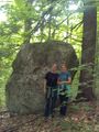
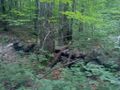
The hiking trail started out in a promising northwest direction, but then turned north to climb the Cotton Mountain ridge. We left the trail, continuing northwest through relatively open forest with a soft leafy floor and modest underbrush, occasionally having the luxury of an old woods road going in the right general direction. After an hour and 10 minutes and a steep descent, we found the hashpoint alongside a big boulder sticking out of the side of the ridge.
We then followed a small creek valley back down the ridge to the backyard of a very nice mountain house, which we crossed to reach the top of the Plan B road. (We find that we are much more willing to trespass on our way home from a hashpoint than we are outbound; is this true for other geohashers?)
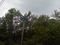
No Trespassing on plan A.
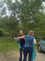
Bugspray trip prep at beginning of Plan C.
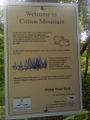
Trailhead sign. This is the closest we've come to sheep on our American geohashes.
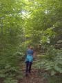
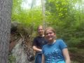
Rebekah leading the way during an on-trail section.
Granite boulder along the way.
Proof.
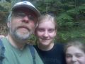
Hashpoint grins.
K&R at hashpoint.
Old stone wall in woods, remains of extensive agriculture here before the Civil War.
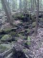
Little stream we followed back to the road, along the track that had been our original Plan B.
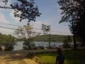
Squam Lake from the point where we returned to NH 113.


Achievements
George, Katja, and Rebekah earned the Land geohash achievement
|
George, Katja, and Rebekah earned the Graticule Unlocked Achievement
|