2014-09-01 51 13
| Mon 1 Sep 2014 in Dresden: 51.0341211, 13.7300125 geohashing.info google osm bing/os kml crox |
Location
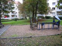
Today's location is in the sandbox of a playground in Dresden.
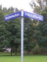
Country: Germany; state: Sachsen (Saxony, EU:DE:SN); district: Dresden; Ortsamt: Plauen; Stadtteil: Südvorstadt-West
Weather: Clouded, a few drops of rain
Expedition
Danatar
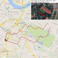
A hashpoint in Dresden, I just had to visit it. But at 4.5 km from my apartment it was a bit far to walk and too close to cycle. As I hadn't been jogging for a week due to time constraints, I decided to do this hashpoint as a jogging route. On Friday already I plotted a tron route. Today after work I started, although some raindrops were falling. Jogging with both a camera and a GPS unit in the pockets of my jacket wasn't the best feeling as they were bouncing around whenever I didn't hold them, but other than that it was okay. I ran through the Großer Garten' park, then past the Hygiene Museum, a very interesting museum. The last part of the route went along boring streets and the main train station until I was near the hashpoint.
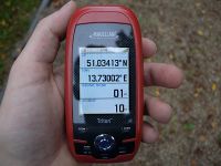
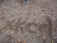
The day before I had been at the train station and while there I had made a short detour to scout out the hashpoint, so I knew it was somewhere near the playground. On the last meters I was extra careful in order to not replicate the tron-destroying error of one month ago. It worked and after a minimal GPS dance two steps to the side I was at the spot, directly in the sandbox. There were no children playing, else it would have been awkward. I took the usual pictures, drew a marker in the sand, caught my breath and started to jog back. For the retour route I took other streets and crossed the Großer Garten in another place. I arrived home after 58 minutes total, not bad with all the traffic lights and the time standing at the hashpoint.
|
