2015-08-13 52 7
From Geohashing
| Thu 13 Aug 2015 in Rheine: 52.7419977, 7.8788615 geohashing.info google osm bing/os kml crox |
Location
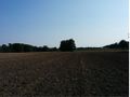
The Geohash is located on a plowed field between Löningen and Essen in Oldenburg.
Participants
Plans
Ride our bikes as far as we can, walk the rest.
Expedition
We rode our bikes.
On our way we saw a street named Kuhdamm. This is notable, because a famous street in Berlin is named Kurfürstendamm, or Kudamm for short. Now a Kurfürst is some kind of lord, while Kuh means cow.
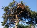
At the coordinates we saw a big bird circling in the sky. We also saw a pine tree, which I usually do not see much. The pictures are included below.
Photos
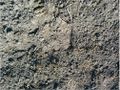
The Geohash
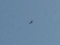
A bird in the sky
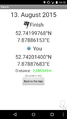
Proof
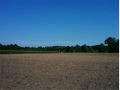
Landscape
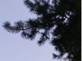
A pine tree
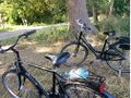
Our bikes


Achievements
Jan and Fippe earned the Bicycle geohash achievement
|
Jan and Fippe earned the Land geohash achievement
|
Jan achieved level 1 of the Minesweeper Geohash achievement
|
Jan achieved level 1 of the Minesweeper Geohash achievement
|