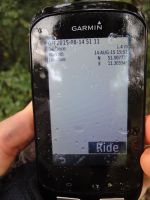
2015-08-14 51 11
From Geohashing
| Fri 14 Aug 2015 in 51,11: 51.0077248, 11.3059386 geohashing.info google osm bing/os kml crox |
Location
At the hillside of inglorious Ettersberg north of Weimar, Germany.
Participants
Expedition
Reinhard planned to cycle from Jena to Erfurt that Friday anyway. Without taking a noticeable detour he rode to the hashpoint, getting quite wet in the rain when passing through Weimar, but at temperatures still around 20°C he let his rain jacket at home and nonetheless was dry again 10 min after the rain had ended. Reaching the hashpoint itself was easy, too, as it was situated right next to a gravel path which was only 150 m from the road leading out of Weimar and up the Ettersberg which is where the concentration camp Buchenwald is located.
Tracklog
Photos
|

