2015-11-30 52 0
| Mon 30 Nov 2015 in Cambridge, UK: 52.7591672, 0.4626307 geohashing.info google osm bing/os kml crox |
Location
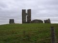
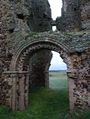
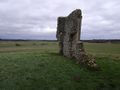
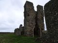
Next to the ruins of St James Church, on the outskirts of King's Lynn.
Participants
- PaintedJaguar (talk)
- MrsPaintedJaguar
Plans
We have the day off work, so will head up to King's Lynn, aiming to be at the hashpoint at around 15:30 (the current rain is forecast to stop from about 15:00). We'll be jumping on a Coasthopper bus from King's Lynn, getting off at South Wootton, and walking approx 1.5 miles along Sandy Lane and farm tracks to reach the hashpoint.
OS maps confirm the farm tracks to the church ruins are a "route with public access" (as distinct from a right of way), but it's not clear from the photos on Google if the ruins are fenced off or not. Some pictures suggest they are, others show what looks like a gate in the fence to allow access.
Expedition
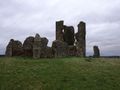
This was easy. So easy that, despite forgetting to bring the paper maps, we were able to reach the hashpoint with just one wrong turning on the farm tracks. The rain had stopped, and although the tracks were pretty muddy, with streams of water still running out of the fields and along the paths, it was not hard to find sensible ground to walk on. The tracks led directly to the ruins, and there was a gate allowing access on the far side of the ruins. The area would be a great place for photos in better light, but today was grey and cloudy.
Photos
to follow
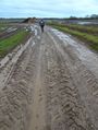
Muddy paths
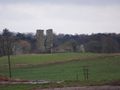
The hashpoint becomes visible
Getting close
Almost there
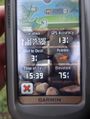
Proof
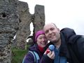
Silly grins
Hashscots
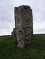
View from the hashpoint towards the ruins
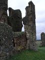
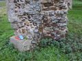
Around the ruins
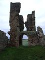
Around the ruins
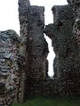
Around the ruins
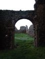
Around the ruins
Around the ruins
Around the ruins
Around the ruins


