2016-01-03 41 -73
| Sun 3 Jan 2016 in 41,-73: 41.0336429, -73.8717493 geohashing.info google osm bing/os kml crox |
Location
By a school in Irvington near the Old Croton Aqueduct Trail
Participants
Plans
Wake up at 7am and hike all the way there, ~17 miles (27 km) north along the Old Croton Aqueduct route, most of it atop the actual old aqueduct in the Bronx and Westchester (including the newly opened High Bridge.) ETA 4pm. Eat dinner in Irvington and finally take Metro-North home. I live a literal stone's throw from one of the original gatehouses in Manhattan, and the hash is nearly as close to the aqueduct proper in Westchester, so a Walk geohash is basically required. OpenStreetMap alerted me to this idea and made for a very useful guide to the route, especially from Van Cortlandt Park to Yonkers (thanks Eupeodes for making it the default at geohashing.info!)
I'm inspired by the crazy hashers of my old graticule at 2015-11-15 47 -122 and also greatly reassured by all the earlier examples atop the table on the Walk geohash page. If I succeed I'll snag a respectable spot there, but I won't come anywhere close to topping Vswe's effort of 2010-11-18 59 17 or several others. (I was a bit disappointed to find this out, but then walking 46km in one day really is madness as far as I can tell.) I've also been catching up with Paul Salopek's walk around the world lately, which makes this extra cool.
I just realized I'll cross my route to 2015-03-01 40 -73 on the way up, passing very close to the point - so I may even take a quick detour to re-document it without all the snow (this winter has been very mild unlike last.) And my train home could carry me back over 2015-09-20 40 -73 if I wish, though more likely I'll get off at Marble Hill and take the subway home.
Things that could go wrong:
-the point could actually be about 15 feet (>1 GPS error radius) *inside* the school... the satellite picture is a little unclear
-parts of the trail through Van Cortlandt Park may not exist anymore... OSM has them but not Google maps
Wish me luck!
-- OtherJack (talk) 22:48, 2 January 2016 (EST)
Expedition
Made it, but phone battery drained several miles before the point, so I won't have a proof photo - just a GPS track which I have no idea how to get onto my computer. It was quite an interesting hike! I'll have more... -- OtherJack (talk) 18:44, 3 January 2016 (EST)
And here is more. I got up at more like 7:45am, so left at about 8:30 that sunny, crisp Sunday morning, a bit later than planned. But managed to get there at something like 3:45pm so I was hiking more efficiently than I'd guessed, despite being a little out of shape.
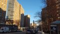
Manhattan
At the beginning it was very quiet and beautiful through west Harlem and Sugar Hill, an area I'd been through several times before but always cool to get a new perspective. In this case I made particular note of the aqueduct gatehouses at Amsterdam/119th and Amsterdam/135th, which I'd only vaguely been aware of before. None of the actual aqueduct was visible yet; in Manhattan it was built deep underground.
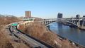
Grabbed breakfast at a deli by City College (2 eggs on a roll, a New York classic) and continued up to the park and the amazing High Bridge to the Bronx, which was totally empty despite the weather. I guess New Yorkers think this is cold. Or they were sleeping in after their Saturday night. The High Bridge originally carried the aqueduct over the deep Harlem River valley; now (as of a few months ago) it's supposed to carry pedestrians. I'd walked on it before but it's awesome every time - see the photos.
The Bronx...
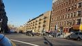
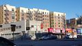
was much more ornate and had a stronger personality than I'd expected - I'd been there for very short periods before but never traversed it at length on foot like this. There were lots of people out, many of them Spanish speaking, and very busy (but low-end) business districts every half mile or so. (In one of them I grabbed some chocolate covered peanuts at a dollar store.) There were also beautiful high schools and churches and a giant sinister looking reservoir.
Much of the way through the Bronx was atop the broad, low ex-aqueduct on paved walking trail, through a sort of long, wide, tree-lined linear park between columns of low brick apartment buildings or side streets. One guy was standing on the trail doing nothing and staring at the sky, I felt bad for him. Other parts were just city sidewalks, where the aqueduct had formerly run. The elevated "4" line of the subway ran parallel a few blocks east, making me think of home again.
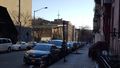
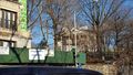
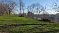
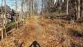
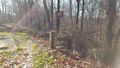
After a lot of walking I reached Van Cortlandt Park about 10:30, which I'd heard was sort of the Bronx's Central Park and was supposed to be pretty cool. Indeed it was a whole world in itself... there were beautiful forests, fields, ponds, a fair number of runners and cyclists out, horse-mounted park rangers. As I'd feared, the aqueduct way was out of commission (because of construction on a highway overpass that it used) so I had to cut through the USA's first public golf course to the Putnam trail, a parallel alternative through the woods.
It turned out there was a high fence separating the golf course from the rest of the park. The Putnam was right there, no more than 15m away, but did I want to scale it? Try to find an official exit? But then it occurred to me, since this was a geohash, there would probably be a conveniently placed hole in the fence. Which is exactly what there was, just a few minutes further down the path! I bushwhacked through (really just picked around some fallen logs) and headed north on the muddy Putnam parallel to the fence.
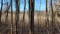
As I continued along, I quickly realized there were many more big holes and blowdowns in the fence, though I'd managed to pick the easiest one. All of them were made by huge dead trees that had fallen onto the fence from the east - from the golf course side onto the trail side, never in the other direction. What so consistently felled all these giants? A very strong wind from the east seemed the most likely explanation. Hurricane Sandy!
The wind from that storm definitely would have been from the east here in NYC, since the center passed through Atlantic City and central Jersey. It could have been another storm, but I don't know of any other recent candidates with strong enough winds. I think this is the first Sandy damage I've seen since moving to New York a year ago (the hurricane was in 2012.) Someone on the internet noticed it too.
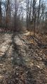
When the golf course was finally finished, I followed some runners east and south through the woods up a steep ridge and back onto the aqueduct, which was much better maintained here. In just a few more minutes I was out of Van Cortlandt Park, the Bronx, and the city of New York, and had entered...
Westchester County.
I didn't even know what town this was, but a sign soon said Yonkers. Here the dirt trail and aqueduct right-of-way wound lightly between old wooden houses in a pleasant suburban neighborhood.
Eventually it entered another big park with a residential road on the right and a steep, wooded drop on the left, sort of Calvin and Hobbes country. Just like the High Bridge, absolutely no one was on this part of the trail! I couldn't believe it - why was nobody outside? It seemed safe enough. The old water towers from the aqueduct were tagged with graffiti but it was of the harmless suburban-teenager kind.
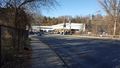
Anyway, by the time I finished this very long straight empty stretch, I was getting quite hungry and it was already after noon. I turned left along a busy road under a highway overpass, following the designated route, and stopped at a gas station deli for half an hour or so:
- 11 or 12 km to go! In Yonkers getting a big sandwich. -- OtherJack (talk) @40.9336,-73.8729 12:31, 3 January 2016 (EST)
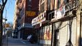
By this time I was already getting sore, but figured I was more than halfway there, and the most scenic part along the Hudson was still ahead. Got up from the booth and continued west into central Yonkers, which seemed a bit down-and-out but pretty and still quite alive. There were actual people on the trail again.
But then I took an anticipated street detour around trail construction and suddenly I was in THE HOOD, wtf. There were guys way too old to be doing hard drugs... standing around in the street clearly on hard drugs and screaming at each other about something. This was way sketchier than anything in the Bronx, which had occasionally been vaguely dodgy but never more than one or two people at a time.
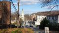
I pressed on and tried not to look at anybody, and thankfully no one gave me trouble. After several blocks (none quite as jarring as the first) central Yonkers became normal again and the aqueduct trail re-opened, now heading north on a residential hillside overlooking the Hudson. Wow. Now I know why Yonkers has the reputation it does, though the vast majority of it wasn't like this. It also might explain why nobody was on the trail over on the suburban side of town - maybe they associate it with this.
Anyway, this part of the trail was much more popular, and as beautiful as I'd guessed, gently winding north above the big river through sturdy trees and between old brick and wood buildings. I passed through the rest of Yonkers and then through the cozy suburbs of Hastings-on-Hudson, Dobbs Ferry, Ardsley-on-Hudson (where it got really wealthy) and finally Irvington, my destination. Unfortunately my phone battery suddenly and rapidly drained in this area, so I don't have a lot of pictures of it. I really need to get it fixed or replaced. I also didn't detour to revisit 2015-03-01 40 -73 in Hastings after all, since I was getting so tired and was worried about losing daylight.
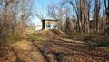
But at long last, feeling very sore but excited, using my written-down directions rather than the phone (having learned from my mistakes on 2015-04-18 41 -74!), I came to Dows Lane. And, yes, I could see it, the Dows Lane School where the geohash lay, just downhill toward the river! Now it was time to find out the true identity of that mysterious gray rectangle housing the hashpoint on the satellite image. I had feared it was the rooftop of some sort of school outbuilding or porch, but thankfully it was just a patio outside what looked like the art and shop classrooms. In a few minutes I had the hashdance finished and the point nailed.
Unfortunately what little was left of the phone battery had totally run out, so I couldn't take a picture and I will have to just say "trust me". If you really want, I can try to figure out how to get my tracklogs uploaded from the GPS (I don't even know what the cable would be called or where I'd find one.)
The return
What with the big Italian sandwich at the deli and all the fruit and nuts from home I'd eaten along the way, I wasn't even hungry, so I improvised my way downhill toward the Irvington Metro-North station based on what I remembered of the map. Had a funny, New York-accented conversation with a random guy on the way down, and in a few minutes I was there. Just missed a train, and nobody at the one open cafe had a phone charger, but this was not really necessary and within 20 minutes I was on another train home. Got the subway at Marble Hill and uneventfully made it back to my neighborhood around dusk.
A convenient grocery-shop and ten-minute stroll, and I was home. 4th longest walk geohash ever!! Google walking directions give 17.2 miles (I'm not counting the brief bits to and from the trains on the way home.) My route was not as direct as Google's since I followed the aqueduct so I'll conservatively say 18 miles, which comes to 29 km. My ankles are still just a little sore, three days later (but in a good way...)
-- OtherJack (talk) 01:06, 7 January 2016 (EST)
Photos
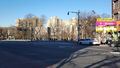
Uptown Manhattan
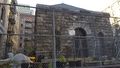
119th St aqueduct gatehouse, near home
Harlem, Sunday morning
135th St aqueduct gatehouse
New York breakfast
Modernist church

...and postmodern? apartment building
The Morris Jumel Mansion, oldest house in Manhattan
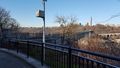
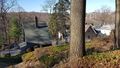
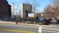
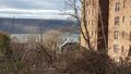
The very edge of Manhattan! Looking out toward the Bronx
An appropriately named spot for hashing :D
Edging toward the High Bridge
Unknown tower?
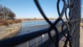
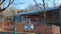
The High Bridge in view!
Robert Moses' America
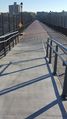
Looking down the empty bridge toward the Bronx...


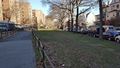
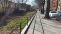
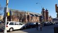
Bronx
...and back across toward Manhattan
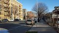
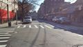
Typical streetscape
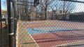
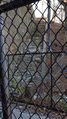
Piece of aqueduct behind a basketball court...
... locked to public access :(
Definitely not in Manhattan anymore!
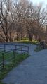
Finally atop the aqueduct!
Looking back along the locked bit
Aqueduct Avenue :D
Much more elaborate church

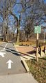
Aqueduct Lands Playground
Typical Bronx aqueduct path
Melvin. just Melvin
Looking east to the 4 train
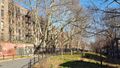
More aqueduct path
The size of the Bronx
What is this?? I still have no idea
Reservoir Avenue
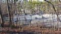
The giant reservoir
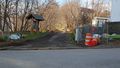
Into Van Cortlandt Park
The way blocked, as feared...
... by highway overpass construction
At the junction
Welcome to America's First Public Golf Course
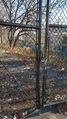
Customary hole-in-the-fence...
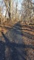
... and finally northbound on the Putnam Trail
Rejoining the aqueduct way
Finally, the edge of New York City. 3 hours and 10 minutes down.


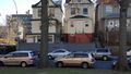
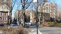
Westchester County
First views

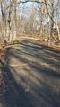
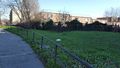
Perfectly empty straight path
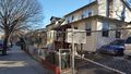
Very quiet south Yonkers
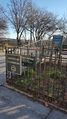
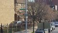
Innocently tagged aqueduct houses
The State Park I apparently walked on for the last half hour
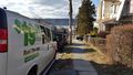
Lunch stop
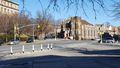
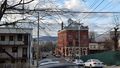
Yonkers spires
Community Garden
Time to detour (into The Hood, as it turned out...)
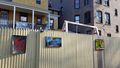
Art! Back on the aqueduct, exiting the hood
Hudson River views all the way up to the hashpoint :D
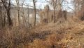
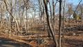
Winter overgrowth
Dobbs Ferry, I think?


...and that was it for the batteries...
Ribbons
OtherJack earned the Walk geohash Achievement
|