2016-03-02 50 7
| Wed 2 Mar 2016 in Bonn: 50.7874135, 7.5490562 geohashing.info google osm bing/os kml crox |
Contents
[hide]Location
Germany, North Rhine-Westphalia, Cologne District, Rhein-Sieg-Kreis, Herchen: a place in the wood near a wet meadow and a hole in the ground
Participants
Plans
Accordering to the route planner it was about 50 km by car to the hash. The position was near Herchen, just south of the 243m high Sonnenberg. Normally I find such distance a little too far-off for a fasthash but Herchen is the final destination of the S12 railway. From there the hash lies 2.5 km to the east. So my plan was to take the train to Herchen, walk the L312 high road for 2 km and then 500 m to the northeast. I wanted to start at Köln Hauptbahnhof (central station) at 15:59. The railway guide told me that the RE 10967, also called Rhein Sieg Express (RSX), would arrive in Herchen at 16:43. Looking at the contour lines of the map it was obvious that the way would lead upward, besides I had to cross unknown territory so I calculated that I would reach the hash at 17:30.
Expedition
To the hash...
The train was nearly in time so I used two minutes to shoot some photos at the station. Then I proceeded over the Sieg river. From here, there was no sidewalk anymore. I had guessed that before (high roads rarely have them) so I took plan B: using the trail in the wood. It was a longer path, at first from Igelshof ("Hedgehog Courtyard") to the northwest, then in zigzag up a hill and then along the L312 (without seeing or hearing it) in 250 m distance. I tried to compensate the delay by running.
(Burgmans rule of fasthash: "When the path goes downhill, as slightly as it may be, then run. Else walk.")
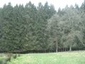
In the wood dusk already started to fall. At 362 m distance I switched the GeoDroid to radar mode and left the path. Almost there?
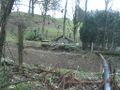
No, there were fences here. On this side of the wood were some farms of the village Ohmbach in sight. I headed to the left to get around the fences and found a classical cabin in the woods. From here I was able to walk further in northern direction and reached to hash at 17:34. So I was nearly in time.
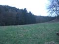
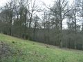
The hash itself was at some trees between a typical wet meadow and a big hole with drainage. Maybe the local farmer wanted to bury an omnibus here - or he was creating a fish pond.
After the running a little refreshment was nice; I consumed a big yoghurt, hoping to get the picnic achievement.
...and back again
On 17:50 I left the not very mysterious crater and made my way south. Thinking about the picnic achievement, I came up with another one. So I did not return on the way through the wood, but went straight to the L312. Not much traffic here. I jogged down to the southwest for some time, and when cars did pass me by, I held my thumb out. Already the second car stopped; the driver identified me as tourist at once, and when I told him I wanted to reach Herchen he concluded "To the station?". Then he drove me exactly there, only 10 m apart from a waiting S19 train. And so I got my Thumbs Up achievement.
The latest public transport achievement I already had earned on my way to Herchen so this journey is the one with the most achievements yet.
The S19 started at 18:09 and brought me back so that I was home after nineteen o'clock.
Photos
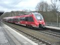
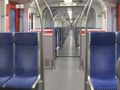
The train which brought me to Herchen.
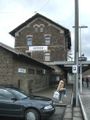
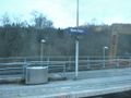
Herchen station.
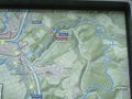
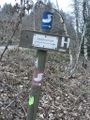
A sign at the station. I followed the blue line ("Etappe 6") about to the place of the "3".
A nice hotel at the bridge...
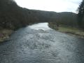
...over the Sieg river.
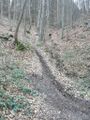
From Igelshof right up...
...into the wood.
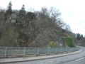
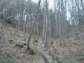
Still following the blue path.
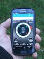
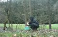
Compass proof
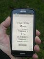
Standard proof
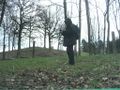
Just at the hash. Grinning.
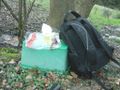
Colourful plastic tableware: check.
Eating while sitting: check.
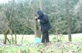
No product placement here.
Southeastern view.
View to the north.
View to the west.
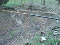
The hole in the ground...
...and its surroundings.
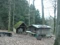
A real cabin in the woods. Beware!
In the train which brought me back.
Leaving Herchen.


Achievements
(If Public transport and Thumbs Up don't mix, then please tell me that, and I withdraw one of them.)
Burgman earned the Public transport geohash achievement
|
Burgman earned the Picnic achievement
|
Burgman earned the Thumbs Up Geohash Achievement
|