2016-07-10 38 -121
| Sun 10 Jul 2016 in 38,-121: 38.5020188, -121.6925195 geohashing.info google osm bing/os kml crox |
About
38.5020188, -121.6925195
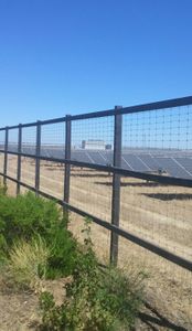
The coordinates in the Sacramento graticule are south of Davis, on Route 35 directly next to a solar farm.
The Journey
Patrick was having a very nice weekend which involved alcohol, live music, karaoke, alcohol, live music, and karaoke (in that order). I checked the hashpoint on Sunday early enough in the late morning/early afternoon to understand that I could get there, but it would infringe on "quality time" with Dr. Brainz ©. She acceded, and we rolled our errand plans into my errant plan, and headed off.
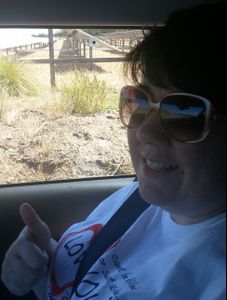
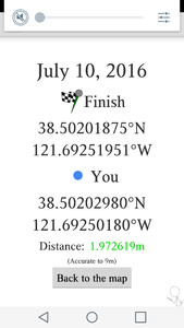
After visiting and utilizing CVS and the Davis Public Library, we drove about 15 minutes down the road, took a brisk left, and we. Were. There, man. The hashpoint was close enough to the road (and the GPS' margin for error large enough) that scaling a fence was unnecessary (NOTE: THAT WAS NEVER GOING TO HAPPEN ANYWAY). Pictures - sadly missing my Stupid Grin - were taken/captured.
We then went to Ikeda's for fresh veggies and cheesestuffs. I neglected to mention that my wife, Dr. Brainz ©, is a trooper regarding the indulgement of what she had - until very recently - figured to be a former hobby.
Pictures
- Pictures
Patrick earned the Drag-along achievement
|


