2016-09-18 52 5
| Sun 18 Sep 2016 in 52,5: 52.0477821, 5.4335369 geohashing.info google osm bing/os kml crox |
Location
Utrechtse Heuvelrug National Park, in the municipality of Maarsbergen.
Participants
Expedition
Today's hash was in a forest in a large national park in Utrecht province. There were a few other interesting sights nearby, so I decided to drive to the hash and do some sightseeing.
At first I visited the Great Pyramid of Austerlitz, built by Napoleon's soldiers in 1804. It was located about 8 km from the hash, so it should have been possible to see the hash from the top. Of course there's no way to make out the exact spot because the entire area is filled with forest, but it was still a pretty nice view.
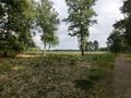
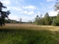
Then I drove a few kilometres nearer the hash and parked my car near the forest's visitors' centre. It was still about a 2.5 km hike from there. The forest was a pretty nice place, with of course lots of trees, but also a few open areas and a few small lakes. The hash was located in a pretty dense part of the forest, so it took a bit of dancing to get a zero reading on the GPS. After taking a few pictures I went back to the car and drove to the pretty little town of Wijk bij Duurstede, where I had a look around the local museum.
Then I went back home, had a bite to eat and then went on another expedition!
Photos
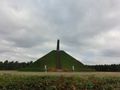
The Great Pyramid of Austerlitz.
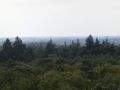
View from the top. The hash should be somewhere over there.
Entering the forest.
It's a lovely sunny day.
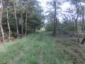
The path leading towards the hash.
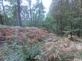
And here it ends.... Didn't bring my machete :-(
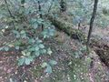
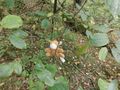
Found the spot after a bit of dancing (which also involved wiping lots of insects, spiders, cobwebs and bits of tree off my face and arms)
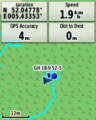
GPS proof.
Lloyd posing for a picture.
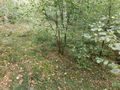
Not much else to see here I guess....
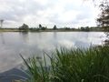
A pretty little lake nearby.


Achievements
FelixTheCat (talk) earned the Land geohash achievement
|