2017-04-06 53 8
| Thu 6 Apr 2017 in 53,8: 53.2418325, 8.5237508 geohashing.info google osm bing/os kml crox |
Location
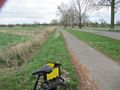
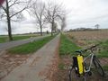
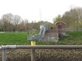
A bike path next to a street near Bremen.
Participants
Plans
I thought, I had set the maximum distance on nathanwoodruff.com to 12 miles, but I got an e-mail notification for this geohash with a distance of about 15 miles. But it was right on the bike path, so I wanted to visit it. I would have had about four and a half hours. School until 1:10 pm, lunch and meeting at 7 pm. I decided that this isn’t enough time.
Expedition
End of school was a bit earlier, so I found that I had enough time.
I made a STUPIDMAP, took some provisions and left Oldenburg together with my bike at 3:10 pm. I followed the Hunte and reached Huntebrück at 3:50 pm. Then I followed some streets to Berne and Ranzenbüttel. The ferry there was really helpful for crossing the Weser. (One ticket with bike is 1€, by the way.) On the other side of the Weser I could see the bike paths and signposts I knew from Bremen’s newspapers. Indeed, I was in Bremen—only one and a half hour away from Oldenburg!
My next destination was Neuenkirchen, but then I lost orientation. A passerby pointed me at a town map, so I could find the geohash easily. Then my STUPIDMAP helped me finding the exact position and I reached the geohash at 4:50. This time I really used STUPIDMAP for navigation, because there were some numbers on it.! Usually I use it as “proof” of location only.
On the way back I saw the train station Bremen Farge, and right then the train departed. I decided not to use the next train to get to the meeting in time, and so I paid for the ferry another time. (Two tickets with bike are 2€, by the way.) At 5:30 I reached Berne, where I could have used the next train to get to the meeting in time. Another time I decided to use the bike. At 5:40 pm I reached Huntebrück, where I recognized that the wind was heavier than I thought. The way back to Oldenburg was exhausting and I had to thought of a capacitor tolerance of 10 minutes to reach the meeting in time.
This expedition was the farest geohashing expedition I ever made, but now I know that it is possible. (With a bit more time…)
I didn’t make many photos, because my camera told that the battery was dead. In fact, it was only a loose contact.
I liked that there are many signposts for bikers in Bremen, although they don’t point to geohashes.
Photos
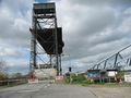
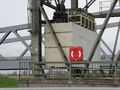
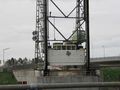
The two bridges in Huntebrück.
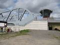
Other part of the new bridge. I think the new one looks more elegant.
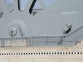
Look at this piston!
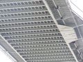
The construction of the older bridge.
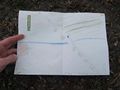
STUPIDMAP sais: Coordinates reached!
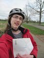
Coordinates reached!
Looking south from the geohash.
Looking north from the geohash.
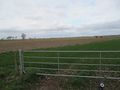
Looking east from the geohash.
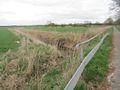
Mühlenfleth, not big enough for a water geohash.
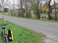
Using the next street sign for proof of location.
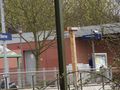
A clock at the train station in Berne. Just after I used my camera’s zoom to read the time from the distance, I saw a big clock only 4 metres away. This was a useless photo!
Back in Huntebrück: one of the couterweights of the older bridge.
Detail: Railing of a ladder.
Counterweight on the other side.
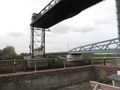
Another view on both bridges.
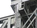
Additional building next to the older bridge. I don’t know the purpose.


