2017-04-20 -37 145
| Thu 20 Apr 2017 in -37,145: -37.9754173, 145.1642288 geohashing.info google osm bing/os kml crox |
Location
On a residential intersection in Noble Park
Participants
Expedition
Pretty simple one this one! I saw the hash in the morning, stuffed around doing stuff during the day of no import to this story, then got home and realised I had three solid hours before I had to be at my parents' place for dinner. What better way to spend three hours than riding two hours out to a geohash and then back again!?
So I grabbed my road bike and hit the surface a road bike is designed to handle. Down along the bay, flying with the tailwind, and then heading inland along Centre Dandenong Road. It followed along my old work commute to EastLink ten years previously, so I had some feels along the way.
With some wrangling, largely dictated by Google Maps, I was there. The hash-point was right at the intersection of two quiet residential streets. So I took the obligatory photos, got back on my bike and rushed off.
This part of the trip turned out to be pretty intense. I suddenly realised how horribly late I was going to be for my parents, and also that I had no front light and it was rapidly getting dark. I outsourced all my route-finding to Google even more precisely this time and headed off into the gloom, passing a station with a train at it in a useless tribute to my loyalty to bikes.
Flying back along the Dandenong Line bike path, I followed the progress of the SkyRail being built there - a project I was considering working on at one stage. And within no time I was rocketing through St Kilda, Middle Park and Port Melbourne and I was home. Just in time to shower, change bikes and ride off to North Melbourne only half-an-hour late for dinner.
Tracklog
Here's my route!
Photos

Felix at the hash

My trusty bike
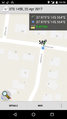
Phone GPS Proof


Achievements
Felix Dance earned the Bicycle geohash achievement
|