2017-06-29 44 -121
| Thu 29 Jun 2017 in 44,-121: 44.1856873, -121.6073778 geohashing.info google osm bing/os kml crox |
Location
Deschutes National Forest, northwest of Bend, OR USA.
Participants
Plans
Beej planned to get on his KLR650 at 3 PM and ride to the geohash from Bend, then grab a trio of geocaches on the way back.
Expedition
What actually happened was Beej spent two hours troubleshooting the safety cutout switches on the bike. Finally, sidestand safety kill switch disabled, he hit the road.
The route goes through the privately-held Skyline Forest before hitting the national forest. The direct route to the hash ran perpendicular to the prevailing ridgeline direction, so direct routes were tough to find.
The first attempted western road had been closed since the last time Beej has been on it, but another slightly north of that was a good substitute.
Three Creek Butte loomed up, and he finally got to a creek crossing over Three Creek. The flow was up and the bank eroded, so he opted to find an alternate crossing. The next one on the map didn't exist; the road simply ended at the creek. But the third one north crossed over a culvert.
Finally the last turn, and Beej and the trusty KLR arrived 40-or-so meters from the hash point.
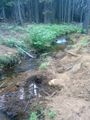
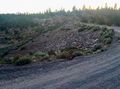
A quick traipse up the hill led to the coordinates in non-descript, recently-thinned forest.
After a few pictures and checking out a nearby lava outcrop, it was time to try to get one geocache, as the day was getting late. He opted for the farthest north one, Way Too Far. At first his GPS tried to route him over an active ditch, was was moderately embarrassing since he did the Open Street Map editing in that area. But approaching from the road above the cache worked.
After that, it was time to route home. Blowdown on the preferred route through an old burn prevented travel that direction, but eventually Beej made it to the old dam at the head of Bull Flat. This dam was constructed in the early 1900s, but never saw use as the ground was too porous to hold water... a fact unfortunately only discovered after the dam and feeder canal were fully completed.
And then off to 10 Barrel to wrap up the night. :)
Tracklog
Photos
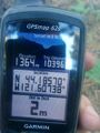
GPS at geohash
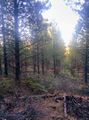
Forest at the geohash
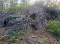
Nearby rock outcrop
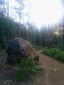
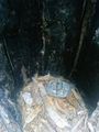
Boulder on the road
Irrigation ditch
Geocaching, too
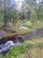
Three Creek
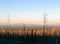
Looking east over an old burn
Dam at Bull Flat
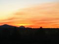
Three Sisters at sunset
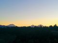
Mount Washington at sunset


Achievements
Beej Jorgensen earned the OpenStreetMap achievement
|