2017-08-01 67 23
| Tue 1 Aug 2017 in 67,23: 67.5843048, 23.9705624 geohashing.info google osm bing/os kml crox |
Location
Kolari, Kuervitikko. The point lies in a wilderness swamp.
Participants
- Pastori
- The Wife
Expedition
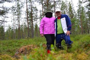
While they are currently traveling in Finnish Lapland, around the scenery of the Pallas-Yllästunturi national park, Pastori noticed that there was an achievable hashpoint near them, so off they went to get it. From their lodgings at Äkäslompolo there was only 7km to the point, were they birds. However, on the ground they had to go around arctic hills and rivers and swamps so it was better to take the car. Suddenly they found themselves near the point, only 300m through a pine forest on to the swamp. Reaching the point was easy and they achieved an accuracy of 1.293m.
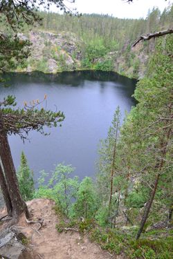
Pastori and Wife were happy with the start to the day and continued their trip to one of the stranger sights around those parts, Pakasaivo. It is a lake with clear water and is located deep in a ravine and legend says it is bottomless. The Ravine is 70m deep and the lake itself 60m. On their way back Pastori wanted to visit an old place of celebration/worship for the Sami people, Kirkkopahta. Pastori climbed the rock to search for new challenges in the horizon.
Photos
Achievements
Pastori earned the Land geohash achievement
|


