2017-08-27 51 10
| Sun 27 Aug 2017 in Goslar: 51.6935476, 10.0123962 |
Location
The hash lay on the western slope of the Wieter hill at Northeim.
Participants
Plans
Hitchhiking and walking.
Expedition
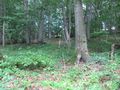
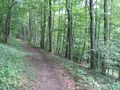
I left home at 11 o'clock and started to hitchhike at 12. With four cars I arrived at Northeim. I walked through the city and climbed onto the Wieter hill. There was a steep way to climb with 55 meters height on 200 meters distance. I only followed the road and first I saw an interesting look to the hill and then my GPS told me, there it is. I got a 3 meter distance and decided, at that stump, there is the hash. But I saw the footway behind and as I am an experienced geohasher in German woods, I wanted to get the zero meter mark. I walked back to the junction and took the footway uphill. And the GPS told me, that the hash was on the way, with the tree stump five meters away.
Afterhash I climbed onto the top of the hill and mounted the tower and had some views around.
Photos
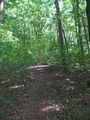
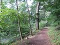
a steep footway
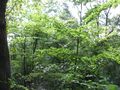
look into the hill
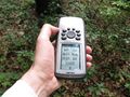
three meters to hash
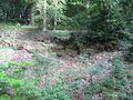
there, at the stump
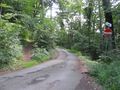
the junction
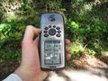
arrived!
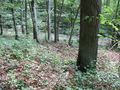
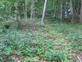
the stump is five meters away
the north
the east
the south
the west

the geohasher
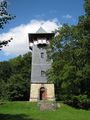
the tower
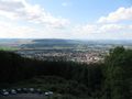
view to the southwestern part of Northeim


Achievements
GeorgDerReisende earned the Thumbs Up Geohash Achievement
|