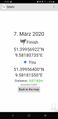
2020-03-07 51 9
| Sat 7 Mar 2020 in Kassel: 51.3995692, 9.5818074 geohashing.info google osm bing/os kml crox |
Location
This Geohash is located on a field in Hann. Münden.
Participants
Expedition
From Hannover, I took the train to Staufenberg-Speele via Göttingen. From there, I walked north toward Hann. Münden. Staufenberg is the southernmost municipality of Lower Saxony, and Hann. Münden. is the southernmost city. The "Hann." in Hann. Münden stands for Hannoveranian, even though it is nowhere near Hannover. It used to be part of the Kingdom of Hannover though, and is uses the "Hann." prefix to distinguish itself from (Prussian) Minden.
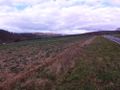
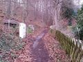
My course took me through some hills where I was walking parallel to the river Fulda which was at the bottom of the hills. The river is a state border here, Hessen is on the other side. I had a pretty nice view. Eventually, I descended from the hill, crossed the train tracks and approached the site of the Geohash. The neighbouring field had a fence around it, but luckily, the field where the coordinates were in did not have one. I was able to locate the coordinates and record proof. It did not look like anybody else was going to show up, so I continued my walk.
I crossed the Fulda and entered the Hessian town of Wilhelmshausen. There was a path right along the Fulda which I followed, continuing to go towards Hann. Münden. An airplane flew pretty low over me, I hoped there was an airport nearby. Later research showed that the closest airport is Kassel, which may have been a possible destination.
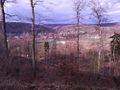
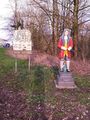
At some point, the state border went out of the river and the path I was walking on became Lower Saxonian. There was no sign of the state border though, only the (Lower Saxonian) Göttingen district thought it was important enough to put up a sign to announce itself. Eventually, I also reached Hann. Münden proper. I walked up to the Tillyschanze, a tower on a hill which overlooks the city. The tower was closed, but the view from the hill already was great. Next to the tower, there is a bar. Interestingly, the state border runs right through the tower and the bar, the tower being Lower Saxonian and the bar being Hessian. The Hessian side is one of the few unincorporated areas in Germany, it is a large forest. The two owners of the bar are the only inhabitants. For a long time, they had trouble receiving mail since they did not have a postal code, but at some point Hann. Münden designated the footpath leading there an official street, meaning the post has to deliver mail there. Hann. Münden was under no obligation to do so, since this technically was Hessen's responsibility.
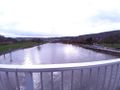
From the Tillyschanze, I walked down to Hann. Münden. The confluence of the Fulda and the Werra is here, forming the Weser. I wanted to see the Weserstein, a stone marking the confluence, but the last bridge over the Fulda was blocked. I had to go around the city, going over the first bridge crossing the newly-formed Weser. From there, I had a nice view of the confluence. I'd like to point out that I also went on an expedition to the Bremerhaven, where the Weser flows into the North Sea. I walked upriver, passed the confluence and crossed the Werra into Hann. Münden's old city. Unfortunately, I ran out of time and was unable to see the Weserstein, as I had to catch my train back to Hannover now. Guess I have to return to Hann. Münden, which is not a pity, since it is a pretty city.
Photos

At the train station in Speele
Leaving Speele
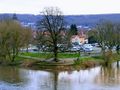
The Geohash is down there. On the other side of the river is Hessen.
Proof
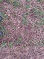
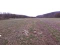
The Geohash
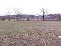
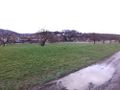
Surroundings
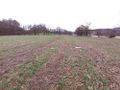
Surroundings
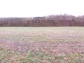
Surroundings
Surroundings
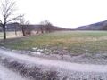
The Geohash site
Approaching Wilhelmshausen
Crossing the Fulda
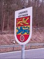
Entering the Göttingen district
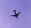
An airplane
Entering Hann. Münden
On the way to the Tillyschanze
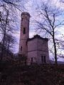
The Tillyschanze tower
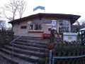
The Tillyschanze bar
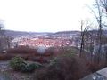
Overlooking Hann. Münden
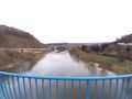
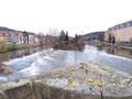
Crossing the Weser
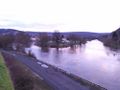
The confluence of the Werra and the Fulda, forming the Weser
The Weserstein
Crossing the Werra
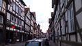
In Hann. Münden's old city
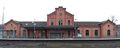
At Hann Münden's train station


Ribbons
Fippe earned the Land geohash achievement
|