2020-04-29 62 29
| Wed 29 Apr 2020 in 62,29: 62.6635212, 29.5585581 geohashing.info google osm bing/os kml crox |
Location
In very uneven terrain, at the edge of a depression, close to roads.
Participants
Plans
This should be easy to access. I might not be able to cycle all the way, but then I can walk the rest. I have been here many times before in orienteering practice events, so the terrain is no problem.
Expedition
I set out from Joensuu towards the hashpoint. I cycled first to Onttola and then towards Härkinvaara along the northern edge of the airport. After a short stretch along Polvijärventie road I arrived at the intersection where the unpaved forest road towards the hashpoint crosses the bigger road. This road also serves as a ski track, and unfortunately there was still quite a bit of snow left. I could ride on it, but it was slow since my tyres were too narrow. I chose the straight route through the forest, and eventually the road narrowed and the snow deepened enough that I continued on foot. I could then walk in the forest where there was no snow.
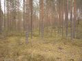
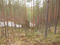
This terrain is extremely uneven and littered with hills and depressions of various sizes. My map image gives a good picture of how it is. It was mostly clear of snow, so I could walk with no problems. When I was only 100 metres away from the hashpoint, I realised that I was on top of a 30-metre-high slope that I would have to descend. All right, fine... Then I found my way to the correct place. It was at the edge of a ten-metre-deep depression, the bottom of which was still covered in snow. I took some photos and walked back to the bicycle. It is a pity that the photos do not show the terrain features very well, but I tried to capture them as well as I could.
This trip was physically somewhat demanding due to the uneven terrain, but there was nothing truly difficult. In hindsight, I could have made it easier by picking more suitable shoes. Studded orienteering shoes would have worked much better than general-purpose trainers. Total distance was 35.6 km, of which I cycled 34.5 km.
Photos
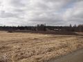
A field in its springtime form.
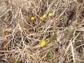
Coltsfoot flowers have appeared.
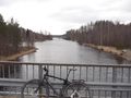
The canal of Höytiäinen.
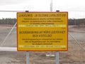
No trespassing in the airport area! I had no need to go there though.
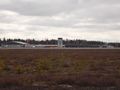
Joensuu airport.
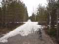
Well, damn... this road is still covered in snow. 1.2 kilometres to go.
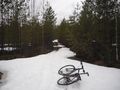
This is where I had to abandon the bicycle. 550 metres to go.
On top of the steep slope, looking back...
to the side...
and down towards the hashpoint. It is behind that large snowy area.
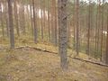
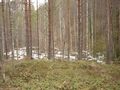
Hashpoint reached!
View from the hashpoint to southwest. The snowy stripe is the road that I chose to not follow.
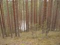
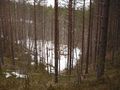
View from the hashpoint to east, the depression.
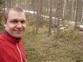
Selfie at the hashpoint.
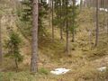
Looking back to the depression once more after leaving.
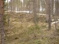
A tiny depression on the slope.
Another look back, showing the last two depressions in the middle.
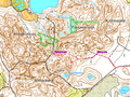
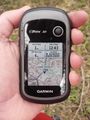
My route near the hashpoint plotted on a topographic map.


Achievements
Kripakko earned the Land geohash achievement
|
Kripakko earned the Bicycle geohash achievement
|