2020-08-28 52 9
| Fri 28 Aug 2020 in Hannover: 52.2732682, 9.4693970 geohashing.info google osm bing/os kml crox |
Location
This Geohash is located in the Deister mountains near Egestorf.
Participants
Expedition
I took the bicyle to the Deister in the morning. As I approached the mountains, the path got steeper. At Egestorf I entered the forest, and the last ~2 kilometers were too steep for me to ride the bicycle, so I pushed it instead. If not for those last ~2 kilometers, this would have been my longest bicycle expedition, but this way it is tied with 2020-04-05 52 10.
Eventually, I took a turn from the main path into a side path, and left the bicycle since it would make no sense to push it through the overgrown path. I reached the coordinates and recorded proof. After reaching the main path and getting back to my bicycle, it was time to ride it downhill. I rested at a bench next to a memorial and was grateful that I brought some food, since I was hungry, despite eating blackberries along the way which grow everywhere here. Riding the bicycle back home afterwards was a lot easier than the way there, since most of the way was downhill now.
Photos
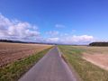
On the way to the Geohash
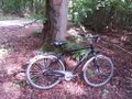
My bicycle near the Geohash

Proof
The Geohash
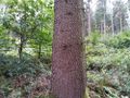
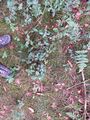
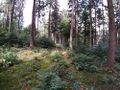
Surroundings
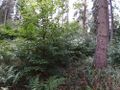
Surroundings
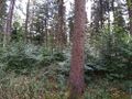
Surroundings
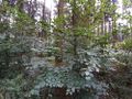
Surroundings
Heading back
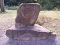
A memorial dedicated to Dr. Heinr. Burckhardt
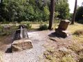
Took a rest here


Ribbons
Fippe earned the Land geohash achievement
|
Fippe earned the Hunter gatherer achievement
|
Fippe earned the Bicycle geohash achievement
|