2020-10-17 51 13
| Sat 17 Oct 2020 in Dresden: 51.0062021, 13.7146370 geohashing.info google osm bing/os kml crox |
Location
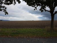
Today's location is in an empty field just south of the Dresden city limit.
Country: Germany; state: Sachsen (Saxony, EU:DE:SN); district: Sächsische Schweiz-Osterzgebirge; municipality: Bannewitz
Weather (4 pm): clouded, 9-10°C
Expedition
Danatar
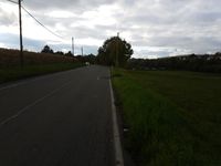
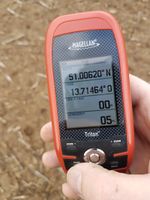
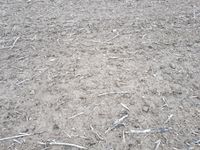
My first day without work or other appointments in weeks and the hashpoint is in reach? Hooray, even if there is a noticable possibility of rain at any moment. I started at quarter past three, cycling through Großer Garten, and the southern city districts. Without any special occurrences I arrived near the hashpoint. I waited until 15:55, then I carefully crossed the field towards the spot. No plants were growing there but some plant parts from the last harvest were lying in the dirt. It had rained very much in the last days but that day had been rather dry so I only sank a tiny bit (perhaps one cm) into the soil, I didn't have to change into the old shoes I had brought precautionarily. At the correct spot I took some pictures and built a marker from some sticks I had collected while crossing the field. Nobody else arrive at meetup time. Then I went back to my bike and cycled home. It didn't rain during the expedition so I didn't have to unpack the rain gear.
|
