2020-10-19 51 9
From Geohashing
| Mon 19 Oct 2020 in 51,9: 51.2378816, 9.0622748 geohashing.info google osm bing/os kml crox |
Location
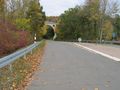
The hash lay on the county road K 19 just near the junction to the national road 485 near Selbach.
Participants
Plans
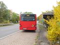
Travel by bus to the bus stop Abzweig Selbach and walking to the hash. On OpenStreetMap there was a path shown Hermannspfad at the side of the road.
Expedition
Arrived at the bus stop as planned. But the path. A path behind the crash barrier, with growing grass, mowed, sloped down to the valley, without any fall protection. I better walked along the road in front of the crash barrier. Later back.
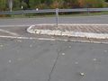
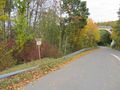
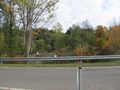
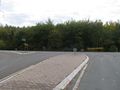
Photos
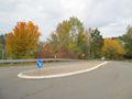
view from the bus to the hash
arrived
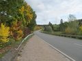
the way to the hash
there!
detailed view

proof
looking north
east
south

west

the geohasher


