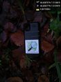
2020-10-30 46 7
| Fri 30 Oct 2020 in 46,7: 46.6087602, 7.2128648 geohashing.info google osm bing/os kml crox |
Location
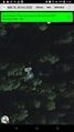
In a forest in the valle Osseyres under the peak Laubspitz, Canton Friburg, Swizerland, Earth.
Participants
Plans
Take a bus as close as possibel, walk up, go down to the hash. After walk to the end of the valley and see if there is a exit.
Expedition
I planed to go to a hill in Neuenburg. In the morning I saw this hash which looked relatively easy to access in the hills here. So I changed my plans.
I took the bus to Charmey, Les Fornys and started walking up the good but steep concrete road. At the junction to the path leading to the hill slope with the hash I thought for some seconds that there is a no trespass sign at the wide open gate. Bringing all my little French knowledge together, I figured that it was just a unfriendly "close the door after you" sign. I left it open as I found it. Later on I miserably failed again at an other gate with the same sign: I closed the gate before I went through, walked around it through the non existing fence and opened it again... It was a bit pointless.
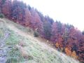
The path went on, got steeper, muddier and slipperier. Looking at the hill slope in the direction of the hash I just wished I brought a rope with me. Of course I didn't think about that before.
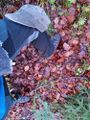
About 100m before the hash I was lucky and a easier way to go to the hash than straight down from the nearest point on the path opened before me. So I jumped the electric wire which was now there. I had to climb some fallen tree and a small stream. I cam closer and the GPS started to play pong with the coordinates. With each jump I had to follow into more steep, moore muddy and more slippery dirt. Finally I caught a reading of under 5m for the second time at one position. I quickly defined it as the hash point. It was at the most steep slope in a 50m radius. Well done.
While I tried to stand and not slip all the way down I took some pictures and barely managed to type and send a "Reached, details follow when I'm out of here :-)" just to say I was here.
Then I climbed up again. At that point I realized that I still carried my big backpack with clothes and stuff for a week with me and didn't drop it near the path as I had planed to do. It must have been exciting!
Back on the road I eat lunch and then continued up the steep valley to search for a way to pass. That was a bad idea. First there was no path (Surprise! There was non on the maps either). Second there where raptors waiting for me! I narrowly escaped them by sliding town a slope on my ass and stumbling in a rocky field. But I survived ;-)
Photos
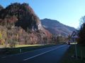
By by bus, hello hill with hash
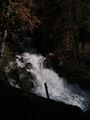
There is some water
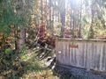
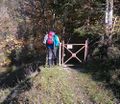
There is a monorail up to where I need to go. But not for me, I walk.
No trespassing???
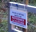
Nop, just close the door.
There is no point here.
Where is my rope?
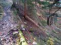
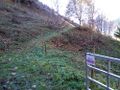
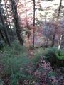
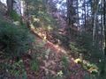
I left the path here
I reached the hash with the promised OSM sticker.@46.6088,7.2130
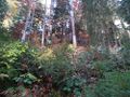
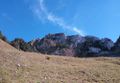
The hash
View down from the hash
View left from the hash
View up from the hash
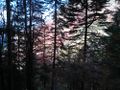
View from the hash
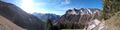
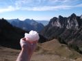
Snow!
You shall not pass!
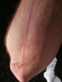
Some of the raptor marks. My wife found more days later...


Achievements
Tungmar achieved level 1 of the Minesweeper Geohash achievement
|
Tungmar earned the Velociraptor Geohash Achievement
|