2020-11-07 49 8
| Sat 7 Nov 2020 in Mannheim: 49.4434585, 8.5091758 geohashing.info google osm bing/os kml crox |
Location
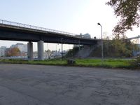
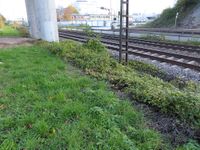
Today's location is on a small meadow between a street and a railroad track at Mannheim-Rheinau
Country: Germany; state: Baden-Württemberg (EU:DE:BW); administrative region: Karlsruhe; district: Mannheim
Expedition
Danatar
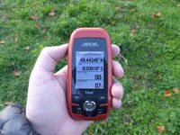
This spot was a nice distance from my parents' place and the weather was good enough for a bicycle ride. I started at 3 pm and cycled across the Neckar bridge to Neckarhausen, then along a field track to Seckenheim, then past Hochstätt and Pfingstberg. Just before crossing the B36 federal road I turned into Casterfeld, there I used a pedestrian bridge to cross the federal road. Shortly after I was near the spot at 15:35. I waited for a while until three youths that were loitering at the corner left, then I went the last few meters to the spot. Finding it was easy, it was in a small meadow directly at the edge towards a railway. I took some pictures, then I waited until 4 pm. Nobody else came. At 4 pm I took another picture of my GPS unit (now the spot was a few meters further into the meadow), then I cycled home along the same route. In total, I cycled 18.8 km.
|


