2021-05-11 53 9
| Tue 11 May 2021 in Hamburg-West: 53.7370170, 9.0563845 geohashing.info google osm bing/os kml crox |
Location
This Geohash is located in the eponymous forested ridge of the Wingst.
Participants
Expedition
I took the train to the Wingst station and walked the rest of the distance. The surrounding area is very flat, so the Wingst ridge, peaking at 74 m, is notable. To name a hill there after Mount Olympus might be an exaggeration, but that is what one of the hills is called - German Olympus.
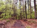
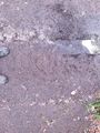
I located the coordinates right on the path and recorded proof. Surprisingly, another smaller, unmapped path merges into the larger path here. It did not go anywhere but a box stand.
Afterwards, I walked to Cadenberge abd took the train back from there.
Photos
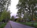
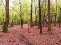
In the Wingst
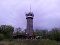
The tower at the German Olympus
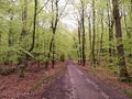
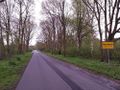
On the way to the Geohash
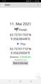
Proof
The Geohash
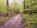
Surroundings
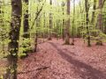
Surroundings
Surroundings
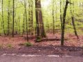
Surroundings
The end of the unmapped path
In Cadenberge


Achievements
Fippe earned the Land geohash achievement
|
Fippe earned the OpenStreetMap achievement
|