2021-08-01 -37 145
| Sun 1 Aug 2021 in -37,145: -37.6778405, 145.7285229 geohashing.info google osm bing/os kml crox |
Location
In temperate rainforest down a gully off the Acheron Way near Mt Donna Buang.
Participants
Expedition
- So success! -- Stevage (talk) @-37.7540,145.6873 13:52, 1 August 2021 (GMT+10:00)
Pre-pondering
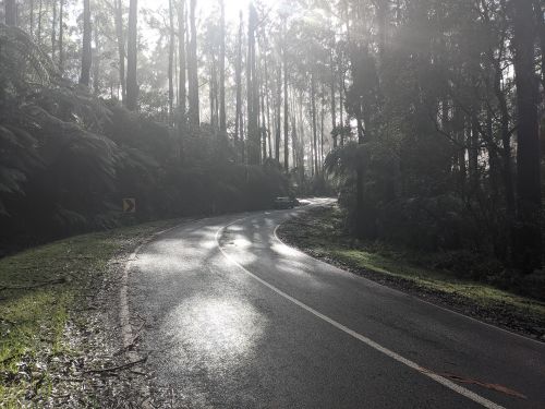
The Acheron Way is a beautiful piece of road, winding its way as a dirt road from the slopes of Donna Buang above Warburton through lush rainforest, climbing slightly before descending to a gem of a little sealed road that gets very little traffic on its way to Marysville. I've only ridden it once before, on an epic one-day ride that took in Lake Mountain and Donna Buang. When I saw that Mother Geohash had chosen to lay an egg along its path, I was pretty excited.
Fortunately, I had planned ahead, and found myself on my way to a camping trip in Warburton when I discovered its existence. Others being either too far away, or nearby but without a bike, weren't so tempted.
Originally I thought of an early morning blast up the hills before brunch with my partner, but heavy overnight rain and a leaky tent moistened my enthusiasm. Still, after brunch in the least-forlorn cafe Warburton could offer at 8am, my spirits were up and I was off.
We climb
Up the hill on my trusty bike. It had been far too long since I'd done any serious climbing like this. By chance I was right behind another cyclist at the start. I'd easily overtake her, right? Actually, no. At a bend, she suddenly disappeared. I hope she's ok.
The traffic started to get pretty heavy. A sign, surprisingly far up the hill, indicated that the road was closed past the summit turn-off, for the snow season. So everyone was either going to the summit, or would be with me the whole way along the Acheron Way, or was about to be seriously pissed off at whoever didn't think of putting the sign further down.
A further sign indicated that chains "should be carried". From where are you meant to suddenly conjure a set of chains up?
But it was delightful to be amongst the trees and the swirling mists, legacy of last night's drenching drying off in the sun. Whip birds, bellbirds, and many others not named after anything auditory. A lyre bird made my trip to the Yarra Ranges complete, dashing across the road, as pretty much they always do.
We branch
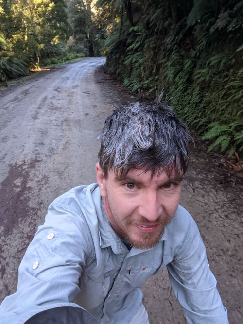
At the Acheron Way turn-off, I got my answer: every single car was going to the summit. The road was mine. I had vague recollections of a smooshy mud road in poor condition, but either my memory was bad, or it had improved a lot. Even with all the rain, it was a solid, packed, well graded gravel road. I hurried along to my jumping off point, trying not to be too alarmed as mobile reception disappeared.
We bush bash
I had estimated 100m of bush bashing. I now saw it was at least 160m. Typical. Cleverly, I had brought good walking shoes to change into, expecting slippery surfaces that my cycling shoes would struggle with. I stashed my bike in a pile of mud and stomped off down the ravine into the dense bush, trying to act more confident than I felt.
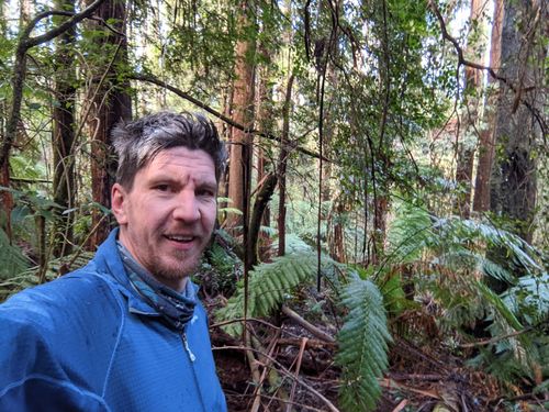
"Slippery" wasn't really the right word. Instead, "squishy", "smooshy" or "squelchy" would do better. Everything I stepped on squished underfoot, as my feet squelched into a smoosh of mud, decaying tree matter, treeferns and organic detritus. Even solid looking branches turned out to be rotten and crumbled under my weight. At least everything was soft each time I fell over - not too much risk of whacking my head on a rock or something.
My new phone wasn't really set up well yet, so I was stumbling pretty blind, hoping I'd somehow just hit the point and not have to dance around much. Which, as it turned out, is exactly what happened. Although as soon as I tried to record the screen, it went from "You're at the point!" to 15m away. So I had to do "the dance" *after* arriving, which felt vaguely deflating. Still, I was surrounded by the world's tallest species of flowering tree, and wasn't yet injured!
Scrambling back up, I got very confused by my map/app situation. I thought I was heading back to the waypoint where I had marked my bike. If I'd looked closer, I'd have noticed that that waypoint was 42km away. No idea what was going on, but I got back ok. With very wet and muddy feet.
We return
We were supposed to be checked out of the camping ground at 12pm. By the time I got back to my bike, it was 12pm, so things were going to be tight. I did my best, but didn't quite get there in time.
Photos
Achievements
Steve earned the Bicycle geohash achievement
|


