2021-11-06 -38 146

| Sat 6 Nov 2021 in -38,146: -38.6400083, 146.1177437 geohashing.info google osm bing/os kml crox |
Location
In a cow paddock north of Fish Creek.
Participants
- Mdixon4
- Felix Dance
- Rhonda
- Ruth
Expedition
Unconventionally, planning for this geohash attempt had commenced some weeks earlier. Felix had gotten in touch to organise a rendezvous.
"Hey Rhonda and Matt, we're booked to stay at the art deco Fish Creek Hotel for the weekend of 6/7 Nov (assuming we're allowed out by then). You're welcome to join us if there's spots left."
Fish Creek was only about 8km from the hash, so it was a good choice. We booked a room and started to plan our approach. Rhonda, juggling a busy study schedule, would drive down in between classes, and meet me at the hash point. I would ride; it looked like a pleasant 75km or so. Felix and Ruth would drive out from Melbourne, do a daywalk and then drive up to the hash. We'd stay at the pub and do a Prom walk the following day.
All went perfectly to plan. Rain was expected later on, but if all went to plan I'd be in Fish Creek by the time it came. In the meantime, it was a bright warm morning, and I headed out, once again, on the beautiful Coalville Road, joining with McDonalds Track and then the delightful route through to Mirboo North I had discovered only some weeks before (2021-10-08 -38 146). By the time I got to Mirboo North, a good spot for lunch after 30km of riding, I'd passed just two cars!
Rhonda had stopped in Mirboo North too, but was stuck in online study group meetings so it was up to me to stimulate the local economy as best I could on my own.
After pumping a little bit of tourist money into the town by way of the brewery, bakery and cafe, I continued on my way. A short stint on Grand Ridge Road, before peeling off towards Mirboo, Milford and Dollar, each smaller than the one before. The road, a firm gravel surface, mainly tracked the ridgelines, giving me plenty of fine views east and west over the bulbous South Gippsland topography. Finally, the hills drew apart presenting my first views of the sea and the imposing hills of the Prom. The sea glinted in the sunlight, but further west I could see the spectre of gathering clouds.
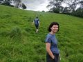
I pushed on, more driven now, towards the hash point. Rhonda had arrived just a few minutes prior, so I met her there, and we waited for Felix and Ruth, who were not far away. Still, the clouds gathered, and we thought we saw flashes of lightning, so Rhonda and I forged ahead into the waiting paddock. A bit of too and fro, and we found the point, so when Felix and Ruth arrived shortly after, we could quickly gather for the photo and return to the road.
There were definitely bolts of lightning now, and distant rumbles of thunder, and the BOM radar had a scary shade of red coming our way. I didn't waste any more time and sped towards Fish Creek. A heavy droplet hit my hand. Another, my neck. And then I was there, sheltering under the porch of the hotel as the deluge unleashed.
It was a perfectly timed escape, and a perfectly coordinated geohash in general. It's lucky that we had started planning some weeks earlier. Should do that more often!
Photos
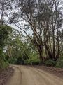
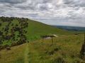
Views from the saddle
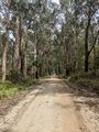
Views from the saddle
Views from the saddle
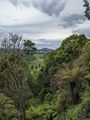
Views from the saddle
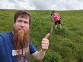
Matt and Rhonda
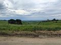
Towards the hash
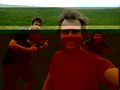
At the hash (glitchy!)

GPS Proof
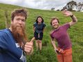
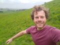
Matt, Ruth and Felix
Departing
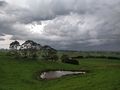
Dam before storm
Unsteady return
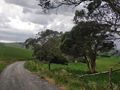
Road back to car
.jpg)
.jpg)
.jpg)
.jpg)


Achievements
Mdixon4 earned the Bicycle geohash achievement
|