2022-03-19 37 -79
| Sat 19 Mar 2022 in 37,-79: 37.1032487, -79.8526801 geohashing.info google osm bing/os kml crox |
Location
On the side of a country road in Franklin County, VA.
Participants
Expedition
After a handful of unsuccessful expeditions several years ago, my interest in adventuring to random places had recently been renewed, and I was determined to successfully arrive at a hash. While working in Martinsville, I discovered that today's hash was along the side of a rural road not too far out of the way of my drive back to Roanoke. Even after a long shift and with little expedition planning, this opportunity was too good to pass up.
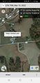
I set off into a pretty sunset after fueling up my vehicle in Martinsville and headed north up US 220. After passing through Rocky Mount and Burnt Chimney, darkness quickly fell. Undeterred, I continued off down country roads to approach the site, encountering only a handful of deer (who did not linger long enough to be photographed) along the way. Arriving at the spot, I pulled over and discovered the actual hash was much closer to the road than I thought, basically right on the shoulder.
I got out and found the point, which appeared to be near the top of a little rise with great views of the surrounding hills and farmland (or would have had great views if I made it before dark...). I realized I should try to leave a makeshift marker since I didn't expect to be launching an expedition today, and attempted to make a tiny sign by writing on a napkin from my car. The fierce winds on top of the hill whipped away my sign into the dark as I was still writing on it, however, so I decided against further marking attempts. The temperature was fantastic on a warm (but breezy) spring night, so I lingered a bit longer and sent some bragging messages to some (confused) friends about a successful expedition. Finally, I got back in the car and headed back home to Roanoke to rest up for hopefully more expeditions in the future.
Photos
Arriving at the spot!
