2022-03-23 -41 145

| Wed 23 Mar 2022 in -41,145: -41.0358862, 145.5663449 geohashing.info google osm bing/os kml crox |
Location
In the Flowerdale River Forest Reserve.
Participants
- John
- Bridget
Expedition
Bridget and I were on holiday, staying at Sisters Beach on the north-west coast of Tassie. Given that there had been no geohashes ever attempted in this part of the world as far as I’m aware, (with a few near Hobart being the only Tasmanian geohashes recorded on the wiki), I kept a very close eye each day on where the local hashes were to assess their doability and whether they would fit in with any other plans of ours.
On this Wednesday morning, it was exciting to discover that there was a hashpoint only 13km south of where we were. It was about 650m from a track into a forest reserve, but hey maybe the landscape might not be too difficult for bushbashing. We decided to mount an expedition in the afternoon, and thought we might continue on to check out Rocky Cape afterwards.
A bit after 2pm, having had a decent lunch of green beans in tomato sauce with roast potatoes, we set off. Even though it was only 13km as the crow flies (or rather, as the forest raven flies, it being the only corvid species found on mainland Tasmania), we had to take a quite an indirect route to approach the hash. There’s only one road out of Sisters Beach to the highway and it takes you quite a way east. Then once we had undone that by driving west back along the highway, we could finally head south. These roads were now pretty slow and gravelly, so all in all it took at least half an hour to drive to the vicinity of the hash.
The problem we then faced was that, although the hash itself was in a native forest reserve, the access from the west (where we were) was along a track through a plantation forest that had only just been logged, and there were signs that said “Danger – Tree Felling Ahead – Do Not Proceed Past This Point” to accompany the piles of logs we could see. We decided we had better not disobey these instructions even though there didn’t seem to be anybody around, so we reassessed the map. Fortunately, we could also seemingly get onto the right road from the south, so we drove on, but not before a bumblebee had seized its chance, a window having been opened to photograph the sign, to burst in and buzz around before our eyes for a few moments before making an equally hasty exit.
Once we’d got around to the south, just where the turn off should be for the road we wanted to be on, we were met with two roads heading off to the left, right next to each other. The first looked like a pretty rough dirt track with a few fallen branches and things on it, while the second was a fairly well-made gravel road. We assumed we were supposed to take the latter, so we headed down it but soon discovered that it was actually someone’s driveway, which included a barking dog and everything. We retreated and made a further assessment of the dirt track which, as was now clear to us, was the right one. Given the fallen branches and so on, it was probably not worth trying persevere in Bridget’s decidedly not 4WD car. According to google maps, it was 1.7 kilometres from here to the point at which we would have to start bushbashing, so by walking along this road it was only going to add maybe 45 minutes to the expedition.
It was a nice enough road to walk along, the first few hundred metres were through lovely native treeferny forest, but it soon opened out such that the native forest of the Flowerdale River Forest Reserve was to our right, while on our left was youthful eucalypt plantation. As we walked along, we saw numerous fairy wrens and grey fantails, and maybe a few other birds that we couldn’t identify.
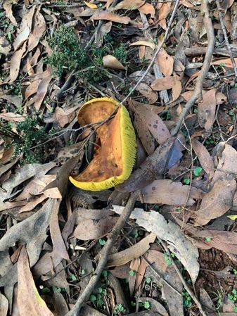
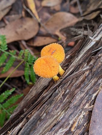
We carefully eyed the forest to our right that we were going to have to venture into. It was hard to judge how thick the forest was going to be – right by the road’s edge there was fairly thick screen of tea-trees blocking the view of the forest behind. We soon reached the point that we needed to leave the track, at about a quarter past three. It was now bushbashing time. We pushed through the tea-trees to discover that initially it was fairly open forest underneath the tall eucalypts, if a little damp. The dampness had its upsides though; it meant that more often than not, the many fallen branches and logs we needed to traverse were soft and decaying enough to fall apart beneath our boots rather than presenting a more significant obstacle. The dampness also provided ideal conditions for the spectacular array of fungi that we saw as we made our way in and out. My fungus highlight was the fuzzy orange one which I think is a Cyptotrama asprata from my subsequent research.

Round fungus
Convex fungus
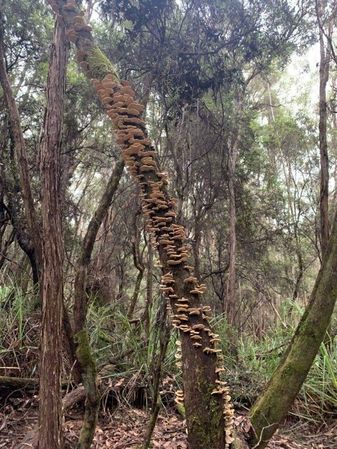
Tree fungus

Pink fungus
Orange spiky fungus

Red fungus

Another orange spiky one
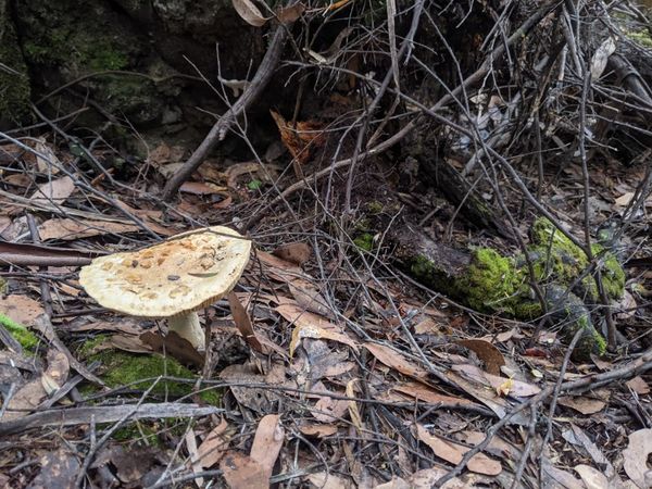
Pancake fungus

John with fungus


After a hundred and fifty metres or so, the going got tougher. There were thicker patches of vegetation that had to be gone around rather than through, and the terrain became more undulating. These factors together conspired to make it more difficult to get a sense of the exact direction we were supposed to be heading in. We crossed one creek valley which was not particularly easy – the valley had considerably thicker vegetation, including a lot of a grassy plant with fairly sharp edges, which had to be avoided as best as possible, and when that wasn’t possible it had to be negotiated with a significant degree of caution. At least the creek itself wasn’t difficult to cross – less than a metre wide it was quite simple to step over.
We made it across to be soon met with another valley that looked very similar. Bridget was beginning to have her doubts about how much further she wanted to go. We’d been going for some time now and there was still some way to go, and without phone signal, she was a bit concerned about what might happen should one of us break a leg or something. We also probably should have let someone know of our plans before embarking on this adventure, but that hadn’t happened. I think in my mind I had been assuming that if anything happened to one of us the other would be able to figure something out.
We decided that we would try and get across and up out of this second valley and make an assessment from what we could then see about whether we were going to persevere or not. So we slowly made our way across in much the same way as we did the first valley. By the time we were on the other side there was less than 200 metres to go until the hashpoint, and as far as we could tell, there were no more creek crossings lying before us.
So we decided we could keep going, but by this point we really had lost our intuitive sense of which way exactly we were supposed to be heading. It occurred to me that it would have been a good idea to have investigated the topography of where we were in advance, and to have already loaded that topographic information on our phones to aid with navigation. But by this stage we were well beyond phone signal range, so we were stuck without it, and were relying just on the little blue gps dot. The gps signal beneath the canopy was not brilliant, and our phones’ ability to tell us which direction we were pointing in was as flaky as it normally is. It was a bit of a process of push on for a minute or two in our best guess at the right direction, wait for a minute or two to see where the blue dot then settled, and then correct as required.
We edged closer and closer until finally at just before half past four, over an hour after we first left the track, on the edge of a slope down into the next valley, the geohashing app lit up green to tell us that we had made it. After a few more minutes of faffing about to take a couple of photos, and to try and get the distance to read as low as possible, we set off on our journey back towards civilisation.
The way back felt considerably easier but in actuality was I think much the same. It still took us over an hour to get back to the track. But without the worries hanging over our heads of “are we going to make it?”, “how much longer will it take?”, “what potential obstacles will we meet?”, it was much less psychologically taxing. Also helping was the fact that it’s much easier to aim for a road that stretches a long way in both directions, compared to aiming for a single point.
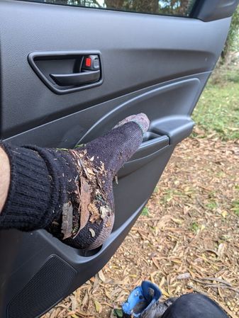
We emerged from the screen of tea-trees back onto the track at just on five-thirty, but we still had to walk the couple of kays back to the car. These passed smoothly, but just before we reached the car, we had the excitement of seeing a wedge-tailed eagle fly by very close by. At the car, we rested, we de-booted, assessed the detritus that had accumulated within said boots, assessed the several scratches on our legs, and enthusiastically consumed the water and snacks that, had we known how much of an effort this geohash would be, we would definitely have brought with us. After our little rest, abandoning our plans to check out Rocky Cape for another day (and as it turned out, for another trip), we headed straight back for Sisters Beach where we enjoyed a dinner of noodles with smoked tofu and veggies.
All in all, I think the the MNIMB achievement would be potentially in the frame here, but I fundamentally disagree with the idea that one’s relationship with Mother Nature should one of being a bitch, in either direction. Mother Nature is not an adversary to be either overcome or succumbed to. Rather, Mother Nature is a friend who needs to be collaborated with to allow you to reach your goals.
I also have my reservations about the terminology and imagery regarding virgin graticules, but I am sufficiently proud of being the first expedition to geohash in this graticule that I will claim that achievement.
Photos

GPS proof
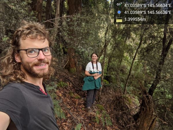
Success! @-41.0359,145.5664

Do not proceed

Broxams Rd

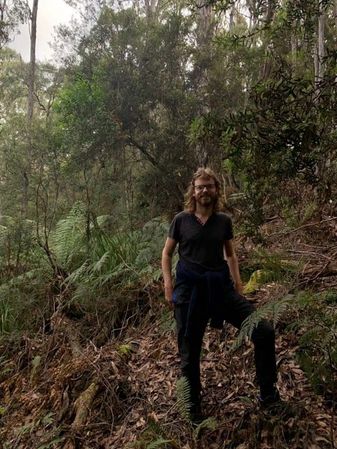
Fairly open to begin with

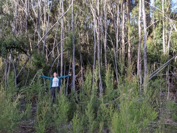
Illustrating the type of sharp edged grass we dealt with plenty of
At the hash
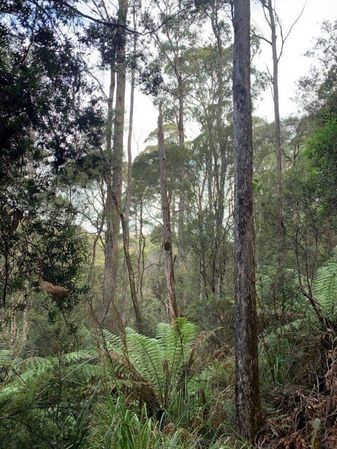
Forest
Bridget emerges from the bush!
Accumulated boot detritus


Achievements
John and Bridget earned the Graticule Unlocked Achievement
|