2022-10-08 -37 142

| Sat 8 Oct 2022 in -37,142: -37.3620416, 142.4901577 geohashing.info google osm bing/os kml crox |
Location
On the side of a hill in Gariwerd National Park.
Participants
Plans
Expedition
Prelude

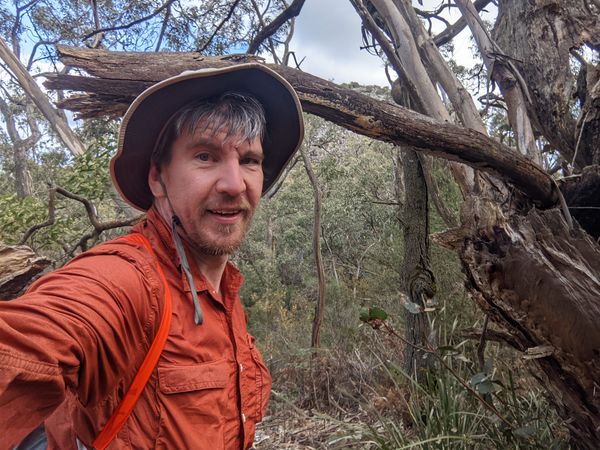
Lachie, Talex and I were on a 3 day cycle tour through Gariwerd, starting at Ararat on the Friday. Alex planned it as a "choose your own adventure", giving him the opportunity to show off his superior fitness on the middle day, while mortals chose lesser paths.
I had been very frustrated by a lack of decent geohashes lately, and was desperately hoping for something achievable during the weekend. Friday's geohash was a painful taunt from the geohashing gods: extremely achievable, just a few hundred metres from where we would be passing on the Saturday. But a day early. And almost impossible to get to by midnight, if we even had the energy.
We rose early on Saturday morning, at the brilliant Kalimna Falls campsite, tucked in amongst native vegetation such as banksias and grevilleas. Alex alerted me to something interesting happening in geohash land. I was confused by the app - it seemed to be in the same location as Friday? I checked back and forth, and saw the new location was very similar, although definitely more difficult to get to. Perhaps 400-500m of bush-bashing after a short walk down a walking track we'd be riding near anyway.
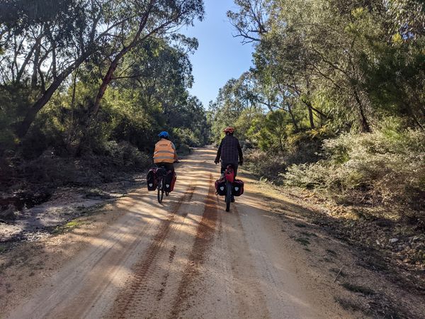
Lachie and Alex zoom off into the distance.
Such a pretty road though.
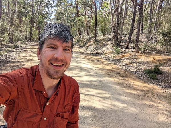
I was enjoying myself.
Taking photos of wildflowers is probably why Alex had to wait so long for me to catch up. Sorry Alex.


Approach
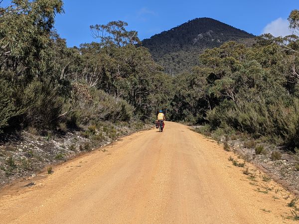
Alex had big plans for the day. 130km or more. Frustrated at my slow pace as I caught up to a regroup point, mid morning he delivered the terse announcement that "I'm at a no-waiting point. I'm going to get the geohash. I need to keep moving, but the geohash is getting done." Such confidence.
Lachie and I tried to keep up with him, but with Lachie's leg cramping, we fell behind. We figured we'd catch up with Alex on his way back out of the bush from that "short" bush bash.
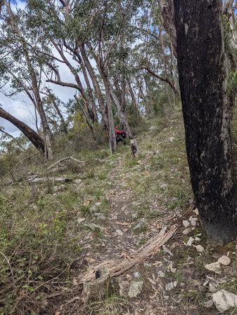
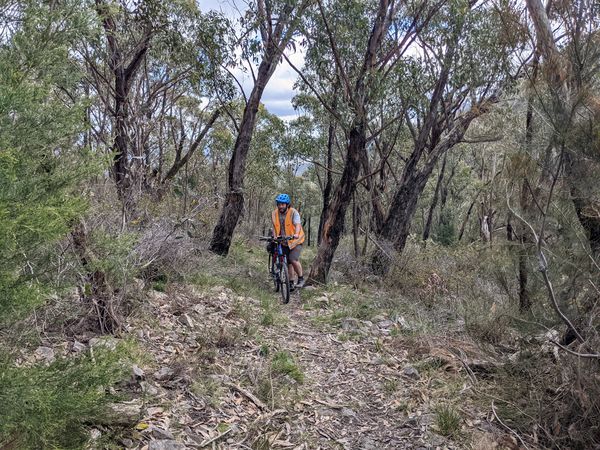
The ride up Teddy Bear Track was nice enough, not too steep, just a good old honest dirt road. We found the walking track we needed, and tried riding it. It wasn't easy, but looked like it might be fun to ride down, so we pushed on. In my case, literally pushing the bike. After a bit, we found where Alex had ditched his bike, so we gave it some company and prepared to walk.
Even though it was supposedly a short bush bash, I have grown wary of such things. I put on long pants, and brought a backpack with water, snacks, rain gear. Lachie is a tough nut and brought nothing, proceeding in shorts.
Soon we bumped into Alex, who had turned back, declaring the bush bash almost impossible, offering us a bit of advice about which way to approach. We wished him well and headed in.
Alex's bike, stashed.
Lachie catching up.
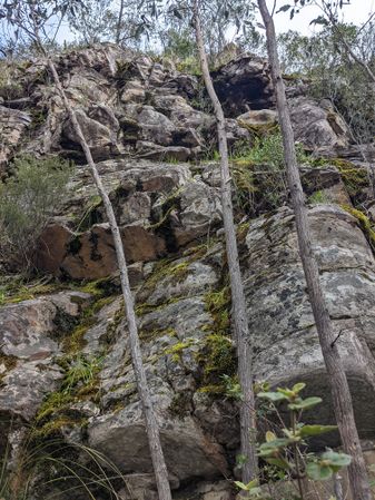
The cliff we must avoid at all costs.


Into the bush

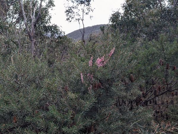
It did look intimidating. Our entry point skirted up the side of a rock cliff, using small trees as handholds to climb up. We climbed and climbed until we reached a small summit, making very slow progress. The wildflowers were outstanding, and continued to get more impressive.
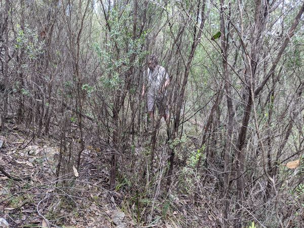
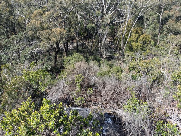
Over the summit we curved to the right, sidling along the back of the hill and trying to avoid losing too much elevation. Down slowly into a saddle, the vegetation got denser and harder to penetrate. Inching forward. We found one good clearing and made a note on the map to try to come back this way.
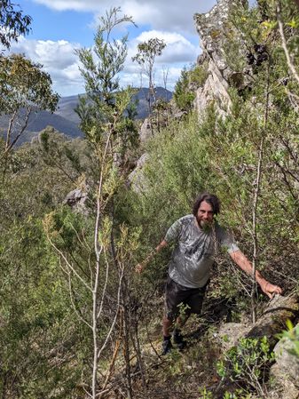
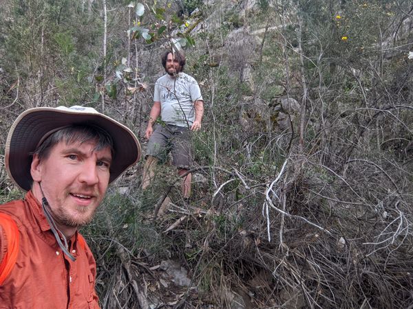
Then finally up and around the hill with the hash on it, metre by metre. Lachie took the lead, finding a route through the scrub while I used the phone to assess whether he was on course or not. It worked pretty well. Eventually we honed in on an unremarkable piece clump of trees, shrubs, and undergrowth. Hooray!
Climbing up through the scrub.
We sidle along the back side of the summit.

Down to the saddle.
Almost a clearing.
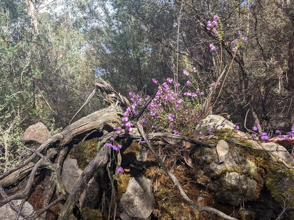
Flowers enjoying this upturned tree.
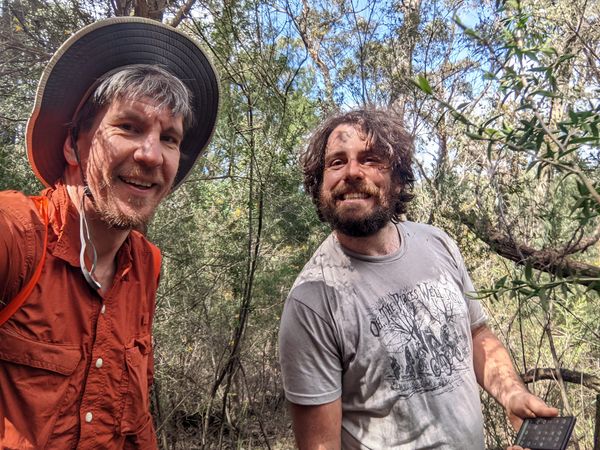
Success!


Out

We took a bit of a different route out, me reasoning that it couldn't really be any worse than what we had encountered so far. Following the path of least resistance led us towards the summit of this second hill, as the vegetation completely opened up and led us to an old rock slide. It was much easier walking on the loose rocks than pushing through scrub.
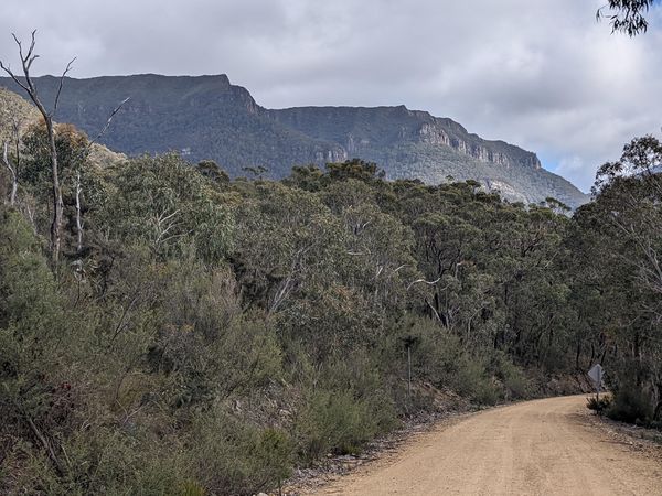
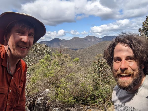
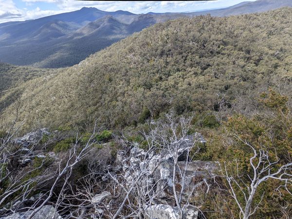
The views from the top were amazing! Spectacular, 360-degree views of the three mountain ranges that make up the Gariwerd region.
Trying to push forward from the summit just led us into an endless range of cliffs, and we slowly circled around trying to find a way down. Eventually we found ourselves back at the rock slide we had climbed up. From there, we were able to sidle across to the clearing we had marked earlier. This time, instead of retracing our steps, we went up the other side, and found a very open landscape, with almost no undergrowth. It was very pleasant, easy walking. Eventually we intersected with our original climb to the side of the rock cliff, and skedaddled down to our bikes.
In all, it took us about 3 hours to get into the geohash and back, a crow-flies distance of just over a kilometre.
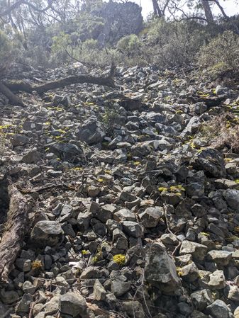
A steep, slippery pile of rocks is still easier than scrub bashing.
So many views!

Another another view.
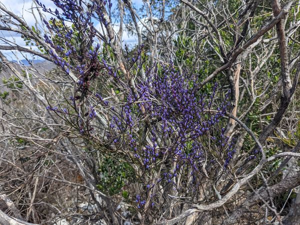
Yet more flowers.
The clearing we are trying to get back to, but not this way.
Lots of hazardous terrain.
If we had found this way the first time it all would have been much easier.
Almost free.
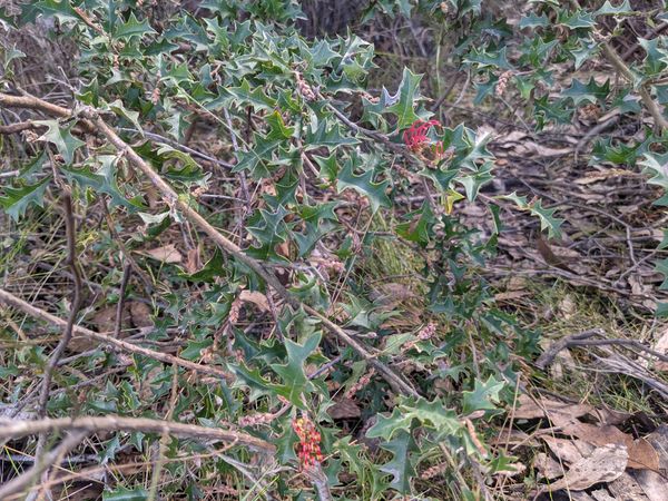
One last grevillea.
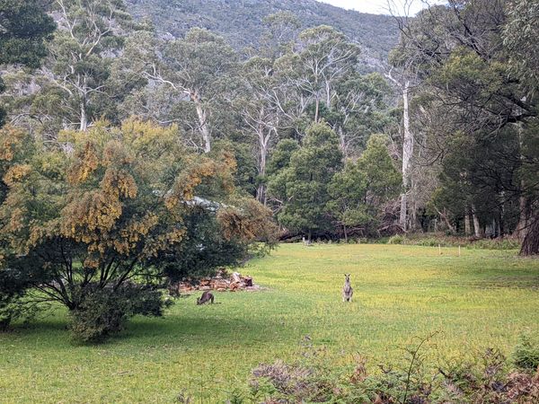
Bonus kangaroos.


Tracklog

Photos
Achievements
Steve and Lachie earned the Bicycle geohash achievement
|