2023-01-11 -43 171

| Wed 11 Jan 2023 in -43,171: -43.0388145, 171.6755386 geohashing.info google osm bing/os kml crox |
Location
800m south of the road near Arthur's Pass, South Island, New Zealand.
Participants
Expedition
Hope

On paper, the hash bore a striking resemblance to the one from a week or so earlier: a steep climb up a hill beside a highway. Nothing too complicated. Right? Oh boy.
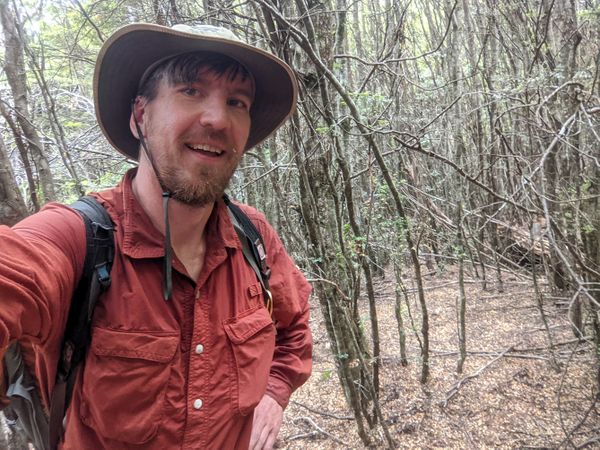
Giving EB the choice between hanging out in Arthur's Pass or waiting in the car below, she opts for the latter, cheering me on as I head off. To last week's kit of gaiters and backpack I add hiking boots and a trekking pole, hoping to really sell the look of "confused trekker" rather than "malicious trespasser" should the need arise.
The hill looks...foreboding. A gentle slope and then suddenly...UP. Where exactly would the hash be? I can't make it out.
The hash is just out of sight, over the top of that ridge.

Disillusionment

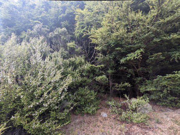
I hop the unbarbed fence and stroll blithely up to the clump of bushes that stands between me and glory, eager to assert myself from the outset. My heart sinks as I take in the magnitude of the clump, a vast tangled wall of matagouri and other shrubs. The word "impenetrable" doesn't do it justice. Even if I possessed the masochist desire to shred myself to death through its thorny defenses, I can't imagine how I could possibly make any headway through this thing. I'd bounce off, repelled like from a spiky force shield.
I retreat and consider another way, shamefacedly avoiding eye contact with EB. Circling around, to my surprise, I learn that the defensive wall is not infinite. A few stomps through a muddy stream (I try not to consider what beast has muddied it) I reach the base of the hill and start upwards. Looking back, I see a tractor with slasher attached turn into the driveway opposite.
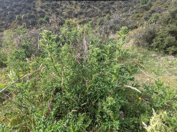
Thistles add to the experience.
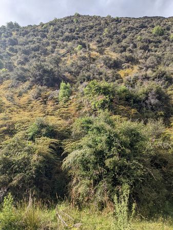
"Intimidating" doesn't begin to describe it.


Determination

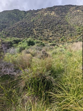
It is hard. It is steep. It is very prickly. The scrubby vegetation is dense. It is maddening. You know there are paths up and through, but you can't see them. There are gaps in the foliage where the ground is lined with rocks, as if a small stream sometimes flows. You take a step up, then slide back. You resist at all costs the urge to wildly flail at vegetation when you slip, for fear of grabbing thorns, or worse.
For it is not just matagouri that lurks. But blackberry, too. As nasty as the matagouri thorns are, there is a sort of honesty to them. They are visible. You grab the thorn, it's going to hurt. And this is their home. But the blackberries? Half the time you don't even see them until they suddenly rip a hole in your leg or claw a gash into your forearm. Thank god for the gaiters.

And then there are thistles. Who invited these bastards? It wasn't me. And for sheer hilarity - roses. Yes. Briar roses roam these hillsides, ensnaring the unwary traveller with thorns every bit like their domesticated cousins. Ouch.
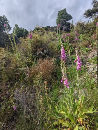
Foxgloves
So much bracken


Despair
So I climb, I dodge, I wince, I stop for water. I watch the tractor below, slowly doing laps of the paddock, working towards the middle. I'm progressing so slowly, I wonder how much longer I have to keep doing this before I can honourably give up, defeated. There's clearly no way I will reach the top.
I plod on. I start to pay more attention to the small tracks through the shrub, and try to follow a few. I suspect sheep, duly confirmed by tiny clumps of wool here and there. The progress improves a bit.
The maddening gambling game continues: look up the hill, and try to guess which way will be easiest. There's a right answer and a wrong answer, but it's very hard to predict. Climb a bit. More water. a snack.
Enlightenment

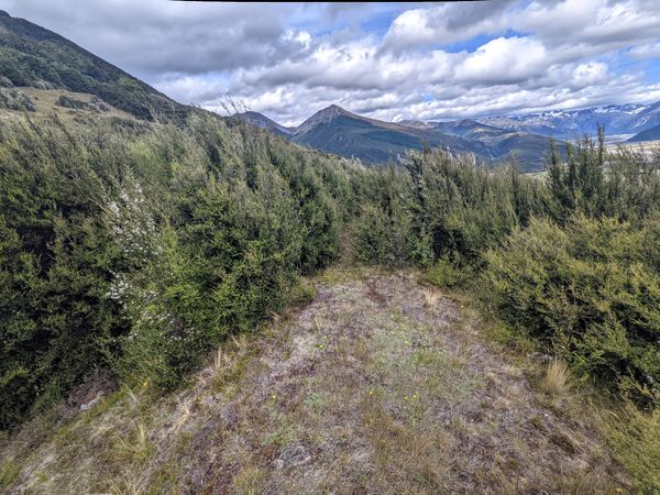
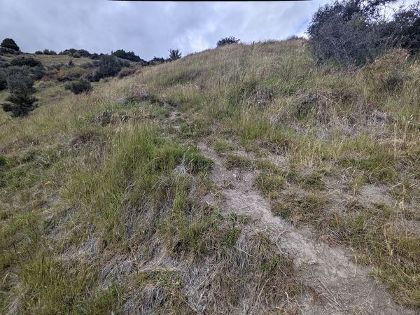
Spot a patch of grass, and aim for that. Yes! Now I'm moving faster. Push, push. The views are incredible.
Climb to a lip of sorts and feel the gradient ease off. This starts to feel like a hike, not just some masochistic hell-dive through a briary thornfield. I'm smiling now, as the sheep tracks lead up the slope, towards my goal.
There are trees now, and they are pretty. I'm on an unexpected embankment - natural? Man-made? I can't tell. The sheep lead me down to a kind of channel. I'm happy to follow, until they head under some low branches that are decidely inconvenient for a human to follow.
The walking is very enjoyable now. I'd be happy to find myself here on a hike. Interesting vegetation, great views, good weather, what a day!

I'm expecting to find the hash just this side of a dense forest high up on the hill, but actually it's a few metres inside. It's a slight let-down, this hash deserves a view, not to hide in the sombre woods. But I'm thrilled to reach the point, and to step back out where a convenient mound offers a perfect viewpoint. I only wish I'd brought a beer.
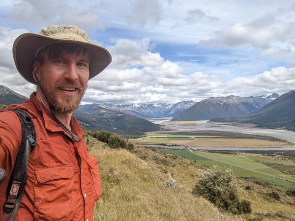
What a view!
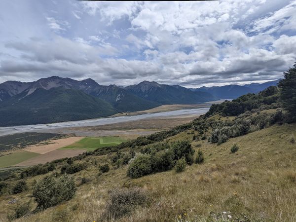
Looking right...
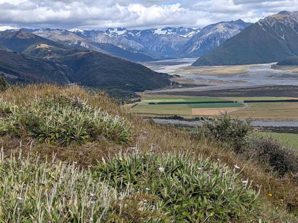
...and left.

More!
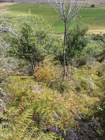
The hash is just within these beech trees.
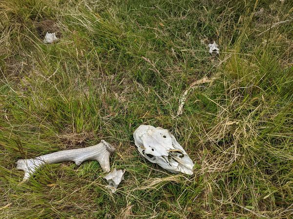
This deer obviously ran into some pretty ferocious sheep.

The hiking is getting much more interesting.


Reflection

The descent is every bit as harrowing as I'd imagined. Foolishly, I thought I could find a better route than the way up, but only succeed in finding even denser brambles. In frustration, I use my aluminium hiking pole as a machete. It responds by snapping in half. I'm unable to find the bottom piece. The tractor has almost finished the paddock. Someone in a ute has come to chat to him.
My lightweight hiking pants are ripped in many places, and there are scratches all over my hands, but I'm filled with a delightful feeling of accomplishment. Back to the car with EB to celebrate!
Tracklog

Achievements
This user earned the One with Nature Geohash Achievement
|
This user earned the Velociraptor Geohash Achievement
|