2023-10-19 48 8
| Thu 19 Oct 2023 in 48,8: 48.2658894, 8.4474214 geohashing.info google osm bing/os kml crox |
Location
Next to the Waldmössinger Straße north of Heiligenbronn
Participants
- Monotof
- Lacreo
Expedition
To the hash point
Lacreo and Monotof were on their way southward together and the hashpoint was pretty much on the way, so we decided to collect it. Especially because it was right next to the road and would likely be easy to reach.
On the way there we were somewhat surprised by a steep valley which we found to contain the river Neckar. At this point the Neckar is far smaller than we are used to it from other places we know downstream. To get down into and out of the valley we drove some pretty squiggly roads (shown in the tracklog below). After lunch in Waldmössingen we drove the remaining few minutes to the hashpoint next to the Waldmössinger Straße. We parked the car were it would not inconvenience anyone and went the final few meters on foot.
At the hash point
The hashpoint was right beside the Waldmössinger Straße with nothing much around. The Waldmössinger Straße is a border between forest and fields, and the hashpoint lay in the forest side. It had been raining today and everything was very wet, so we were glad we did not have to trek through the forest, but just past the very first trees. The Hashpoint itself was unremarkable, but the real achivement was that it was both Lacreos first Geohash and Monotofs first non-solo Geohash. After taking all the prerequisite pictures we contiuned our way southward, since the weather and location were unfavourable to prolonged stays.
Photos
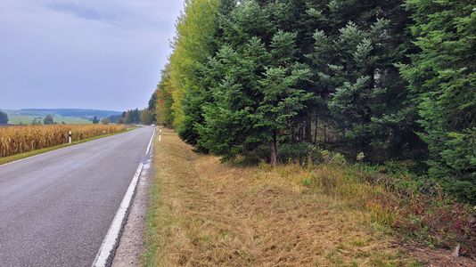
Approach to the hashpoint
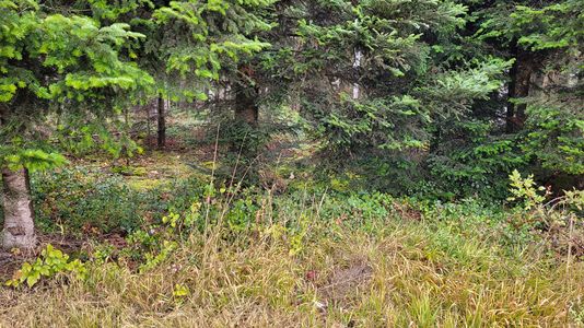
Hashpoint in the center
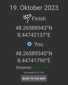
Proof

Stupid Grins™
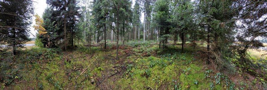
Panorama at the hashpoint


Squiggly Road
Achievements
Lacreo earned the Land geohash achievement
|