2023-10-23 47 8
| Mon 23 Oct 2023 in 47,8: 47.9977171, 8.4662711 geohashing.info google osm bing/os kml crox |
Location
In a field in the Brigachtal
Participants
- Monotof
- Lacreo
Plans
Since the hashpoint was 4 km away from our (temporary) residence and the weather was supposed to be nice (or at least dry) we decided to walk to the hashpoint today. We included a stop at a very nice supermarket and bakery in our route planning for a coffee break. It would be a ~13 km trek.
Expedition
To the hashpoint
We started from our place of residence in Tannheim and made our way across and under some major roads and up our first small incline to the edge of the forest. From there we had a nice view of Tannheim behind us. We treked through the forest on forestry roads which were easy to walk on, but apparently were mostly planned and made with a stright edge with little regard to height changes.
We saw a lot of traces of logging activity, but overall the forest seemed healthy. It had thick underbrush in some and a thick moss carpet in other places. In the forest we came across a wooden hut, the Weißwaldhütte. It was locked.
Once out of the forest we came across a very artisticly decorated house and garden. The fence was handcrafted metalwork with beautiful and funny scenes depicted. In the backgarden there was a big construction for high up kids play: Platforms, bridges, a slide, different obstacle sections, a climbing wall and even a hand-operated elevator. All handcrafted, likely by the homeowner.
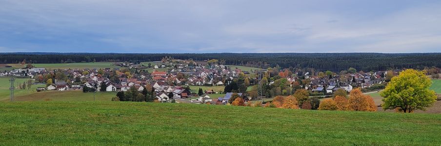
After that, it was only a few meters to the hashpoint. We had to approach it in a little roundabout way because there was some thick underbrush in our way which we had to go around. Nonetheless it was pretty easy to get to in a field between the main road and the trainline.
At the hashpoint
The hashpoint was in a field with still some plants growing, but it was easy enough to traverse without trampling the plants. The ground and the plants were still wet from morning dew, so our shoes did get wet here. Since there was nothing much to see at the hashpoint itself, and our shoes would only keep the dampness out for so long we just took the prerequisite pictures and continued on. Out next target was the supermarket.
Way back
We went northward and just stayed on the main road through Klengen. On a monday morning there wasn't too much traffic. We tried to get into the St. Blasius church but it too was closed and locked. From an information sign on the outside of the church we learned about a devastating fire which destroyed half the village in 1893.
We arrived at our intermediate destination: a very nice, less than a year old supermarket with attached bakery. We got coffee, hot choclate and cake and enjoyed it in the nice seating area of the bakery.
After the refreshments we made our way back to Tannheim on a path through fields with less altitude changes. We came across a wall painting on a garage which humorously suggested someone parked their locomotive in there. On the final 2 km we got hit by a bit of rain, but we made our way undeterred.
Photos
View of Tannheim

Weißwaldhütte
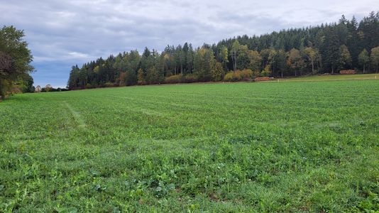
Hashpoint roughly in the center
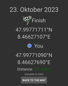
Proof
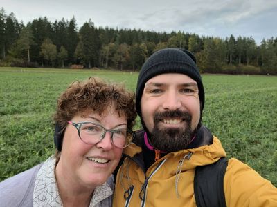
Stupid Grins™
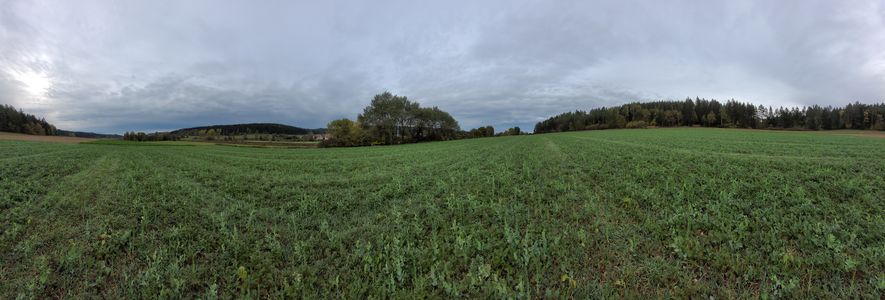
Panorama at the hashpoint
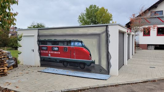
humorous garage painting


Tracklog
Achievements
Additional Information: Tannheim is not our permanent place of residence, but we spent our vacation there. Since the location was planned and we already stayed there well in advance of the hashpoint location being known this should still qualify us for the Walk achievement.
Monotof earned the Walk geohash Achievement
|
Lacreo earned the Walk geohash Achievement
|