2023-12-10 32 35
| Sun 10 Dec 2023 in 32,35: 32.5983240, 35.0740951 geohashing.info google osm bing/os kml crox |
Contents
[hide]Location
In a field, near a river, near Kibbutz Dalia and Ramot Menashe. It's difficult to tell whether the field is agricultural or not.
Participants
Yerushalmi (talk), his wife, and #1-5
Plans
We needed to go to Haifa at some point during the Chanukah vacation, so we picked today because the point turned out to be on the way. The plan is to drive to the nearest field edge, find a place to park, walk to the point, maybe have a picnic, then walk back to the car and continue to Haifa.
Expedition
We left the house a little bit later than intended, and partially because of that I made my first major mistake without realizing it: upon plugging the coordinates into OSM for route guidance, I assumed it would take us to the nearest road edge, and didn't check exactly which road edge that was.
As a result, when we arrived, instead of taking us to route 6952 (along the northern edge of the field), it took us to the intersection of routes 672 and 6953 (on the eastern side) and expected us to drive into the field itself. There *was* a "road" there, but it was extremely muddy due to recent rainfall and definitely not something our bog-standard minivan could handle.

But no big deal. A path's a path, and according to the map this path takes us all the way to within 100 meters of the point, so why not walk down it? All we'll need to do is cross the river at the end. And besides, Street View showed a barbed-wire fence along the southern border of 6952, so coming from that direction also has its risks. Might as well try the approach that we happened to end up taking.
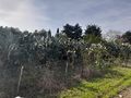
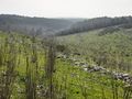
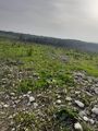
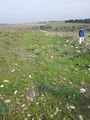
Problems began immediately when we discovered that #5 was wearing sandals, which meant it was difficult for her to navigate the mud - especially at four years old - and we couldn't go into the field to the north because of the crops growing there. But we navigated our way down to the first intersection, then the second, at which point the path began to descend down the side of the hill. This was a blessing, as it became a lot more rocky and a lot less muddy. In fact, we found a good place about 250 meters from the point to sit down and eat sandwiches.
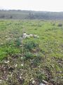
Shortly afterwards was this curious, extremely faded sign with what looked like two bullet holes shot through it:

It's just a warning not to dig or build in the area because of underground water pipes, but this sign has *clearly* seen some rough times - especially because given the phone number it can't have been put up before 1995.
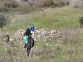
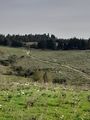
We continued down the path and saw this interesting structure to the north of the path:

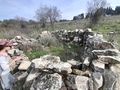
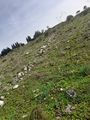
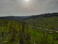
There was clearly an Iron- or Bronze-Age settlement here at some point. You'll see in a lot of other pictures the remnants of ancient walls that are now just a row of loose rocks in an unnaturally straight line.
Then we reached the final intersection. Only 100 meters from the point. The hashpoint is on the hill opposite, we can see it! All we need to do is cross the river!

Correction: All we need to do is reach the river and then cross the river! Because that, my friends, is a massive wall of thorns considerably taller than I am, blocking any further progress.
At this point my wife and #5 decided to sit down off to the side and wait while the rest of us headed north, looking for a break in the wall. The area got increasingly muddy but there was no luck. At this point #1 dropped out as well. So we turned around and headed south, then west, still looking for a break. No luck, and this is when #4 dropped out.
We continued west, because looking for where the satellite photo said would be the thinnest part of the wall - maybe we could break through? But still no luck.
So we turned around and went back to the car. But I didn't want to give up just yet - we might still make it to the point if we try coming from the north, where there's no river and wall of thorns between us and the point. There was some debate, but in the end some of us still wanted to go for it. So we drove up to the Ramat Hashofet Intersection and turned left on 6952. After a bit of effort we found a place to park on the side that was near a deliberate break in the barbed-wire fence (there were several unintentional and/or vandalized breaks in it, and I didn't want to use those). Me and #2 and #3 set out, while the rest stayed in the car.
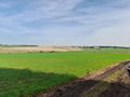
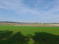
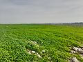
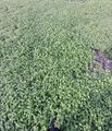
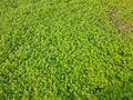
We wanted to be mindful of not entering anything that looked like a field in active use. There seemed to be one to the east, but we needed to go south. This was fine at first - but then we came upon this massive spread of extremely beautiful bright green ankle-deep foliage.

We couldn't tell if it was deliberately planted or not, so we took a massive detour to the west. Then we began heading downhill into a kind of valley, then uphill again, then downhill towards the river.
At this point the foliage began again, but there were hundreds of rocks embedded in and around them - I mean hundreds. In straight lines, too, half-long-buried, more remnants of whatever ancient town had clearly been built on both sides of this river thousands of years ago. This was comforting, because it meant the foliage was natural and we wouldn't need to detour around it again on the way back.
From there it was a pleasant stroll to the point, and an *extremely* pleasant walk through the foliage back to the car.
Photos
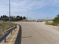
Ein Hashofet Junction
The entrance to the path, with a cattle grid.
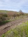
This is very muddy
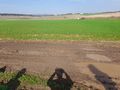
We have to stick to the southern part of the road because the northern part is clearly planted
But the southern part also has its challenges
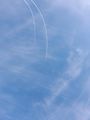
Contrails (or chemtrails in US English)
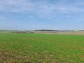
Beautiful views that I am not qualified to photograph
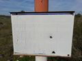
A sign that has aged far more than it should
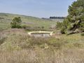
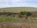
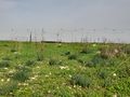
Some kind of reservoir in the distance
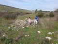
Investigating a curious ancient structure
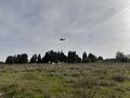
Military overflight
Trying to find a break in the wall of thorns
Oh come on, the hashpoint is right there, we can see it!
Some ancient wall used to go through here
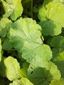
Coming in from the other side, a massive field of green
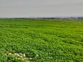
This is beautiful, but I'm not sure I can step in it
More ancient walls
From this side of the river we can see on the other side the path that we had come down two hours earlier

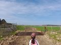
Proof
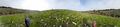
Panorama at the point
It was like running through a cloud
Beautiful!
Can anyone identify this?
Some old and rusted-out irrigation equipment
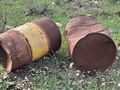
Old and rusted-out oil drums belonging to the Paz Oil and Chemicals company


