2024-03-03 49 9

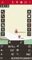
| Sun 3 Mar 2024 in 49,9: 49.9763065, 9.0494526 geohashing.info google osm bing/os kml crox |
Location
The hashpoint lies at the edge of a field, directly next to a shrub, a few meters away from the closest track (which isn’t mapped yet in OpenStreetMap) next to the Gersprenz river, in Aschaffenburg county, Bavaria, Germany. The closest settlement is Stockstadt am Main in east direction.
Participants
- Green guy! (talk)
- Manuel (a new friend and fellow of mine from CGD)
- Green guy!’s mother (no consent to publish photos of her)
- Green guy!’s father (no consent to publish photos of him)
Plans
- Drive to Stockstadt am Main after church service
- Go to a restaurant in Stockstadt for lunch
- I wasn’t able to find any good restaurants which were open at noon – except for the Italian Trattoria Isola Bella, which looked really promising. I chose this one as the recommended option.
- Park on the parking lot next to Da Michele, an Italian-food delivery service
- Reach the hashpoint by foot and have a lot of fun and joy
- Finish the expedition by going back to the car to then drive back home
Expedition
Around 12:05 pm, after being done with this Sunday’s church service at CGD, I invited my new friend Manuel to participate in this day’s expedition. He quickly agreed, so my parents and I took him geohashing by car (again, with no stopover at our home): We took the B26 motorroad (trunk road) headed towards Dieburg, and kept driving straight on (leaving the motorroad, but staying on B26) through Babenhausen, crossing the state boundary from Hesse to Bavaria.
As planned, we went to the Trattoria Isola Bella to feed our empty bellies. The trattoria (which is a smaller, familiar-atmosphere version of a restaurant, according to their website) turned out to be really inviting and calm (which typically isn’t the case in our home city, Darmstadt, with there being a lot of noise in restaurants at noon in addition to the evenings). Also, the trattoria stands out for offering pinsa (a flatbread similar to pizza, but with the dough risen for 48–72 hours) in addition to pizza. I opted for a Pinsa Napoli (which is the pinsa equivalent to a Pizza Margherita) and Manuel decided on a pasta dish. All in all, it was a cozy meal.
After eating our fill, we went on driving closer to the hashpoint (traversing a level crossing in the process) and parked our car on the parking lot next to the Da Michele delivery service, as planned.
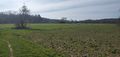
Starting from the parking lot, we went on a clockwise walking route to the hashpoint and back to our car: First, we walked on tracks next to the Gersprenz river. Then, we turned left onto a track which is missing from OpenStreetMap before I add it, leading to a weir with fish pass where the Gersprenz splits up. We really liked the white noise emitted by the water flowing over the weir; and continued our walk by turning right. Going straight on, we got really close to the hashpoint after a while. Going through a few meters of straw, we reached the hashpoint on the field’s edge, with a prominent shrub next to it. Obviously, Manuel and I took our first partner selfies at the hashpoint. Going on, we had a delightful walking route (between trees, besides fields and next to allotments) with a lot of opportunities for me to survey various stuff for OpenStreetMap.
Tracklog
The tracklog shows my anti-clockwise walking route (this time with good GPS accuracy, but I forgot to start the logging immediately) and all locations where I took photos. (I took a lot of photos because the scenery was so beautiful to me.) Notice that I surveyed some tracks which aren’t in the OpenStreetMap database before I add them.
Pictures

This expedition’s lunch: Handmade, delicious Pinsa Napoli with cherry tomatoes and leaves of basil
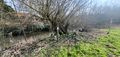
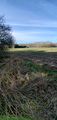
Beaver’s lodge: Danger of collapse
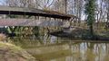
Photo by Manuel
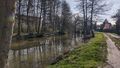
Photo by Manuel
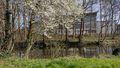
Photo by Manuel
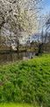
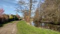
Photo by Manuel
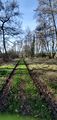
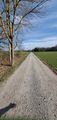
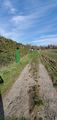
Walking on the unsurveyed way
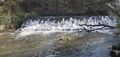
The weir
The weir, photo by Manuel
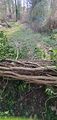
Had to step over this fallen tree

Photo by Manuel next to the weir
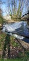
Next to the weir; you can see a fish pass
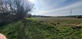
Approaching the hashpoint
Going through some straw to reach the hashpoint
Coordinates reached
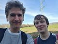
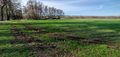
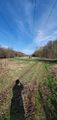
Our first in-pair selfies: Manuel on the right, me on the left; field behind us
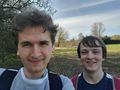
Field’s edge visible behind us

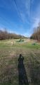
Prominent shrub behind us
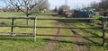
Hashpoint right ahead, at the edge of the field, right of the prominent shrub
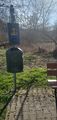
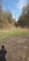
Bench (cut off because someone was sitting on it) and bin (waste basket) for OSM
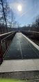
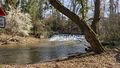
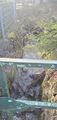
Bridge across the Gersprenz
View from bridge
According to OSM data, there’s a track going right next to the fence on the right … going to fix that soon as in reality (left side) you have to take a detour to avoid that shrubbery!
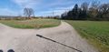
Turning circle
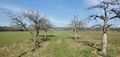
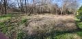
Some battered-looking trees
Turning left
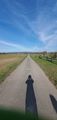
Looking into the distance
One more track missing from OSM …
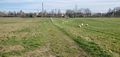
… and another one! There are also sheep.
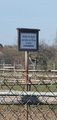
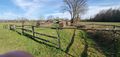
Entering the paddock and feeding the horses forbidden – Parents are liable for their children’s actions
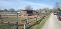
Some bay horses
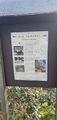
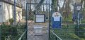
The apiary: A tradition with new goals
(information board 1/5)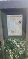
Bee honey: A versatile natural product
(information board 2/5)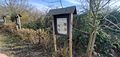
Bees’ produce: What bees give us besides honey
(information board 3/5; two more on the left)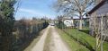
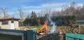
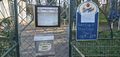
Fun fact: It is common to encounter the classical elements of air, earth and water in everyday life … but actual fire is a rare sight for the majority of people.
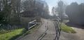
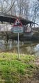
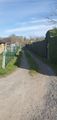
Back at the Da Michele parking lot: Cycle barrier leading to a roofed bridge over the Gersprenz
Da Michele’s compound:
CCTV surveillance is being used in this area!
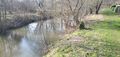
Stream next to Da Michele’s compound


Achievements
First-time
I earned these for the first time from this geohash.
Green guy! earned the Consecutive Bonza Bottler Day achievement
|
As this is my first geohash outside my home graticule, I earn the following achievements:
Green guy! earned the 2-in-a-row achievement
|
Green guy! achieved level 1 of the Minesweeper Geohash achievement
|
Recurring
I already earned these from an earlier geohash, but fulfilled the conditions again on this one.
Green guy! earned the OpenStreetMap achievement
|
Green guy! earned the Land geohash achievement
|
Green guy! earned the Drag-along achievement
|