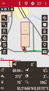
2024-07-13 50 8
| Sat 13 Jul 2024 in 50,8: 50.2166294, 8.5512527 geohashing.info google osm bing/os kml crox |
Location
On a footway in the northwest residential area of Oberursel (Taunus), Hochtaunus county, Hesse, Germany. The Camp-King-Park lies to the east.
This day’s weather: cloudy in the forenoon, sunny in the afternoon, 20–23 °C
Participants
Forenoon:
Noon to afternoon:
- Green guy! (talk)
- Green guy!’s mother
- Green guy!’s father
Plans
Green guy!
- Drive to Oberursel in the forenoon
- Park our car near the hashpoint
- Walk to the coordinates
- Have an enjoyable walk in the Camp-King-Park
- Have lunch at a nearby restaurant
- Drive back home
Monotof
- Cycle to the hashpoint
- Have lunch in the nearby park
- Cycle home
Expedition
Monotof
Even though it was pretty cloudy and some of those clouds were rather dark, i got on my bike and rode through the hilly Vordertaunus towards Oberursel. Riding through the Residential zones of Bad Homburg and Oberursel especially on the hillsides there were some quite nice homes.
I arrived at the hashpoint at ~11:50 and took the prerequisite pictures. Afterwards i sat on a nearby bench and ate the lunch i brought: Bread, Cheese, Snack-Salami and Blueberries. After keeping a lookout for Green guy! without luck for ~30 min i got back on my bike to ride home.
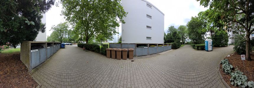
Panorama @50.2167,8.5512
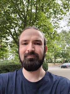
Stupid Grin™
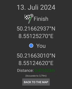
Proof


Green guy!
The way to Oberursel with obstacles
My parents and I started driving towards Oberursel (Taunus) around 12:30–12:45 pm – not quite in the forenoon anymore. While still in Darmstadt, we decided to refuel our car as the fuel wouldn’t suffice for the way to Oberursel and back home.
However, just as we were done refueling, we got a call by my older sister who informed us that she had forgotten her latchkey, locking her out of our home. For charity’s sake, this circumstance demanded us to drive back home again to unlock the door for her, which was an additional challenge of patience for me. Upon being done with that, we finally made our way to Oberursel via the A5 and A661 motorways.
Delightful lunchtime
As everything took longer than expected and our hunger grew, we decided to have lunch before continuing with the expedition. We drove to the Italian restaurant il Gondoliere, parking our car on the neighboring parking lot which has a maxstay limit of 1.5 hours.
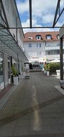
Approaching the restaurant il Gondoliere
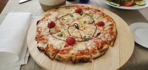
Pinsa Margherita for myself; notice the brown spiral made with balsamic vinegar
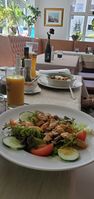
Front: My mother’s chicken salad
Back: My father’s lasagna


The restaurant turned out to be wonderful: The staff was joyful, the background music wasn’t loud at all (although it was popular, not Italian, music), and the food was palatable and made with love. I ate a delightful Pinsa Margherita (pinsa being offered is often a sign of high quality due to the 72-hour proving time of the dough), while my mother had a tasty chicken salad with a spicy passionfruit dressing and my father enjoyed a delicious lasagna.
When we were done, the waiter surprised us with a free slice of tiramisu for each of us. As we were stuffed, we only managed to eat one of three slices, taking the rest away. As the restaurant also offers home-made ice cream (gelato), we planned to come back once more after the expedition. In conclusion, it was a great time and a new source of nice memories for us.
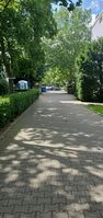
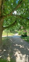
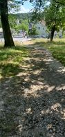
Reaching the coordinates: a walk in the park
After lunch, we parked our car on a public parking lot south from the coordinates and walked our way to the hashpoint, reaching it a few minutes after 3 pm.
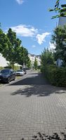
Getting close
Almost there
Coordinates reached!

Funny grin
Looking south
Looking north


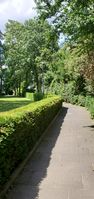
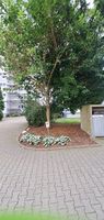
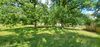
Then, we had a literal walk in the park: the Camp-King-Park, to be exact. It was more sunny (and therefore warmer) than expected, but still very manageable. After leaving the park, we also walked a bit through the residential area.
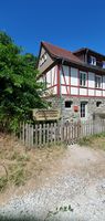
Waldorfkindergarten Helmut von Kügelgen


No appetite for ice cream
With the walk in the park finished, we drove back to il Gondoliere to get ourselves some Italian gelato. However, I was still too full from lunch, so I didn’t have any appetite for a dessert. The waiter even gave me small spoonfuls of various flavors to try, but I wasn’t convinced by any. After all, I tend to like warm dishes like pizza and pinsa a lot better than sweet desserts such as ice cream.
Back home
I was feeling really tired after this expedition. When I checked this expedition page after arriving at home, I noticed Monotof’s additions, which makes this geohash the first time that I share the expedition page with someone else.
Final verdict
Awesome trip with some obstacles, but delicious and sunny memories.
Tracklog
Monotof: Cycling to the hashpoint
Green guy!: Walking to the hashpoint and in the park
- GPS accuracy: medium (bad near the location of our car, where it looks like I walked through a building even though I was farther to the west)
- Markers show all locations where I took photos (including some photos taken near the restaurant) – some all of them are taken for OpenStreetMap surveying and not uploaded here.
Achievements
Monotof
Monotof earned the OpenStreetMap achievement
|
Green guy!: Recurring
I already earned these from an earlier geohash, but fulfilled the conditions again on this one.
Green guy! earned the OpenStreetMap achievement
|
Green guy! earned the Land geohash achievement
|