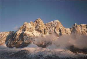
The Jasper, Alberta graticule is located at latitude 52, longitude -118. Straddling the border between Alberta and BC, as well as the Continental Divide, it includes the town of Jasper and a chunk of Jasper National Park in Alberta, as well as a large chunk of Mt. Robson Provincial Park in British Columbia (though not Mt. Robson itself), including the headwaters of the Fraser River, and a large portion of Kinbasket Lake (part of the Columbia River system) as well as bits of other provincial parks in British Columbia. Spectacular barely describes this graticule.
Geohashes
None yet.
