Talk:2015-11-10 52 4
From Geohashing
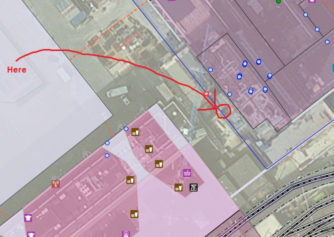
Hello fellow hashers. I used OpenStreetMap tools to locate the hashpoint. I think this is better than Google where the 3D effect makes it impossible to judge where the ground level point is. Using this image, can you remember if you were there? Perhaps you can now claim "coordinates reached".
