Geohashing Poster Tool
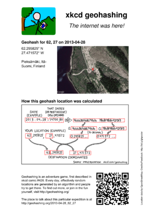
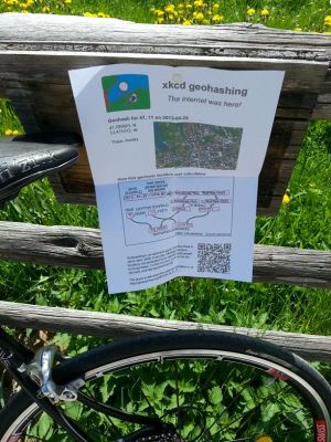
Since I had made my first poster/marker, I had planned to automate the task. For a while, PDF posters were available from the Active Geohasher website, but as of May 2013 it has been down ("Offline for Maintenance") for several months. So I relaunched the project from scratch, and here is the result.
Usage
Posters are available from the following URL:
http://geo.crox.net/poster/[date]_[lat]_[lon]
eg for today's hash in 46,6, go to http://geo.crox.net/poster/2025-04-03_46_6
Minimal globalhash support is also available:
http://geo.crox.net/poster/[date]_global
eg for today's globalhash, go to http://geo.crox.net/poster/2025-04-03_global
=> Basically, just use the same address as the expedition page, but replace the hostname and path by http://geo.crox.net/poster/. The syntax that was used by Active Geohasher is also supported (with / as separator instead of a space/underscore).
From an expedition page, you can link to the poster like this:
[http://geo.crox.net/poster/{{FULLPAGENAME}} Poster for this expedition]
The QR code will link to the corresponding expedition page. You are encouraged to put some sort of welcome message for people who would visit the page after having found the poster in the wild. This can be achieved for instance by adding the "Advert" template to the top of the expedition page and its talk page:
{{Advert}}
This will add the following banner to the expedition page (and a slightly different one to the talk page):
| Have you seen our geohashing marker? We'd love to hear from you! Click here to say "hi" and tell us what you've seen!
Curious about what geohashing is? Read more! |
Credits
The tool builds upon work made by others, as well as several online services:
- Active Geohasher as general source of inspiration
- Customized comic based on Hugo's work
- GeoHashing logo based on Dawidi's work
- DJIA info from geo.crox.net
- Reverse geocoding location info from OpenStreetMap, GeoNames and Google (the tool tries to get the best match, and shows which source was used on the right of the poster)
Aerial imagery / maps from Google- Static map images from OpenStreetMap - map data © OpenStreetMap contributors
Feedback
Your feedback and suggestions are more than welcome! Please use the talk page.

