Difference between revisions of "2024-07-05 48 7"
From Geohashing
([live picture]I'm back!) |
|||
| Line 9: | Line 9: | ||
-->{{meetup graticule|date=2024-07-05|lat=48|lon=7}} | -->{{meetup graticule|date=2024-07-05|lat=48|lon=7}} | ||
== Location == | == Location == | ||
| − | + | In a forest near Denzlingen. | |
== Participants == | == Participants == | ||
| − | + | * [[User:LeslieHapablap|LeslieHapablap]], ([[2018-06-19 48 7|previous]]|next) | |
| − | -- | ||
== Plans == | == Plans == | ||
| − | + | I got an app alert about a nearby hash point. Indeed, it was almost directly on my route to work. | |
== Expedition == | == Expedition == | ||
| − | + | Not much to tell :) Biked to work, made a very short detour to reach the hash point. It was located in a forest area, and the mosquitos enjoyed my visit. | |
| − | |||
| − | |||
| − | |||
== Photos == | == Photos == | ||
| Line 36: | Line 32: | ||
{{#vardefine:ribbonwidth|100%}} | {{#vardefine:ribbonwidth|100%}} | ||
<!-- Add any achievement ribbons you earned below, or remove this section --> | <!-- Add any achievement ribbons you earned below, or remove this section --> | ||
| + | {{land geohash | ||
| + | |||
| + | | latitude = 48 | ||
| + | | longitude = 7 | ||
| + | | date = 2024-07-05 | ||
| + | | name = [[User:LeslieHapablap|LeslieHapablap]] | ||
| + | |||
| + | }} | ||
| + | |||
| + | {{bicycle geohash | ||
| + | |||
| + | | latitude = 48 | ||
| + | | longitude = 7 | ||
| + | | date = 2024-07-05 | ||
| + | | name = [[User:LeslieHapablap|LeslieHapablap]] | ||
| + | | bothways = true | ||
| + | }} | ||
__NOTOC__ | __NOTOC__ | ||
<!-- =============== USEFUL CATEGORIES FOLLOW ================ | <!-- =============== USEFUL CATEGORIES FOLLOW ================ | ||
Delete the next line ONLY if you have chosen the appropriate categories below. If you are unsure, don't worry. People will read your report and help you with the classification. --> | Delete the next line ONLY if you have chosen the appropriate categories below. If you are unsure, don't worry. People will read your report and help you with the classification. --> | ||
| − | [[Category: | + | [[Category:Expeditions]] |
| + | [[Category:Expeditions with photos]] | ||
| + | [[Category:Coordinates reached]] | ||
<!-- Potential categories. Please include all the ones appropriate to your expedition --> | <!-- Potential categories. Please include all the ones appropriate to your expedition --> | ||
Revision as of 19:07, 14 July 2024
| Fri 5 Jul 2024 in 48,7: 48.0805176, 7.8572925 geohashing.info google osm bing/os kml crox |
Location
In a forest near Denzlingen.
Participants
- LeslieHapablap, (previous|next)
Plans
I got an app alert about a nearby hash point. Indeed, it was almost directly on my route to work.
Expedition
Not much to tell :) Biked to work, made a very short detour to reach the hash point. It was located in a forest area, and the mosquitos enjoyed my visit.
Photos
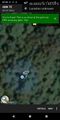
I'm back!

Achievements
LeslieHapablap earned the Land geohash achievement
|
LeslieHapablap earned the Bicycle geohash achievement
|