2024-10-11 52 4
| Fri 11 Oct 2024 in 52,4: 52.1061314, 4.2951224 geohashing.info google osm bing/os kml crox |
Location
In a wooded area in Scheveningen
Participants
Expedition
After my failed multi-hash on 2024-09-27 where both hashes were not reached, the Hash-gods had been cruel and had not given me any good hashes that I could get. And then this one came along. In a small forested area, in a coastal town near the Hague, I knew it was perfect for me. Only problem: I had to work during the day and I had another appointment in the evening. So there was one solution. Get up stupidly early, grab the first train out of Tilburg, get the hash and get to work before 8:45.
Fun detail: on the day before, I was home late as well, so I got about 4.5 hours of sleep this night. Any typos or other mistakes in this report will be blamed on this lack of sleep.
Anyways, I got up at 5 and left my house at 5:15. Grabbed my bike to get to the train station and took the train to Rotterdam. In Rotterdam, I changed to the metro to The Hague. In the Hague, I had to search a bit before I found my next mode of transport: the tram to Scheveningen. All of this was pretty uneventful to be honest. The trains and the stations were pretty much empty this early on, and I could barely see anything outside because it was dark as night. Because it was night.
I reached the right stop in Scheveningen and had to backtrack a bit. Strangely enough, Google Maps tried to tell me that I had to follow a road that was not a road at all, but seemed to be the below ground parking space of an elderly care center. I decided that today was not the day to try my luck there. Instead, I went around and easily found the bike path to the hash in a small wooded area in the Nieuwe Scheveningse Bosjes (new little forest of Scheveningen). There was an odd moment where I saw something on the bikepath that looked like a sign or a lane divider. It was right on the border of deep shadow and half shadow. I didn’t feel like approaching it and stepped off the path to check my location on my phone. That’s when a dog suddenly ran out of the woods and went up to the object. The object started moving and it became clear that it was just a bicyclist who had been standing still for a while. Kind of weird, but nothing dangerous, I guess.
I followed the path until I had to go onto a horse track which was very sandy. I kept ruining my night vision because I had to check my phone, so the path seemed even darker than I guess it was. The pictures seem to fluctuate between “it’s not that dark” to “wow, it’s always darkest before the dawn” type of lighting. The droid app showed the hash right off the path, but when I wanted to check where I had to go into the woods, the app told me that I was within 80 centimeters! I walked around a bit, but I did not get another reading than that the hash was ON the path, and Google Maps had it wrong. I quickly snapped a selfie and a couple of pictures and continued my journey as I still had to get to work. By now it was around 7:35.
While walking back, I reflected on all the modes of transportation I had used to get here, and I figured I might as well use one more. So I found a busstop to go the The Hague central station. From there, it was another train ride, but with a slightly better view as the sun had finally come up. In the end, I reached Utrecht at 8:47 which meant that I had completed the expedition on time, and none of my co-workers were any the wiser that I had already travelled 3+ hours to get to a randomly generated GPS-location in a small wooded area. Succes all around, I’d say.
Photos

5:15 AM

Nice and calm

More quiet than I’ve ever seen it

No picture, but this was the path taken.

Bit more people here, but still way to early

Funnily enough, rather busy. Barely a place to sit.
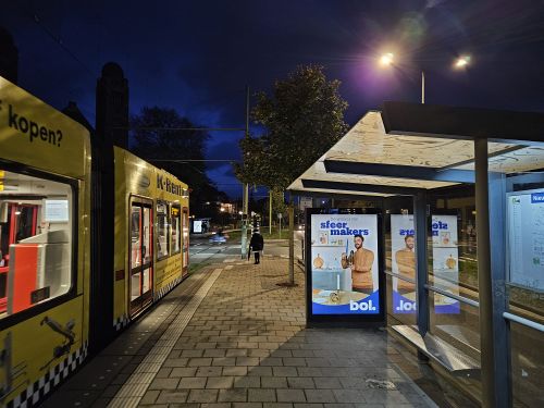
My stop for the hash

Google though this was a road.

It was not this bright in real life
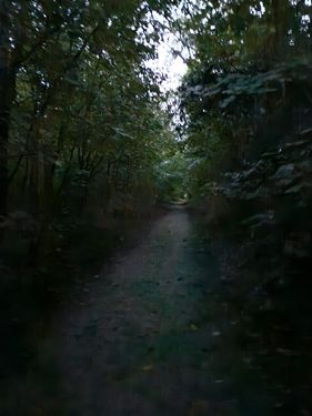
It was darker. I would not have liked seeing anyone else here
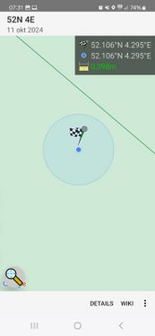
Lucky me
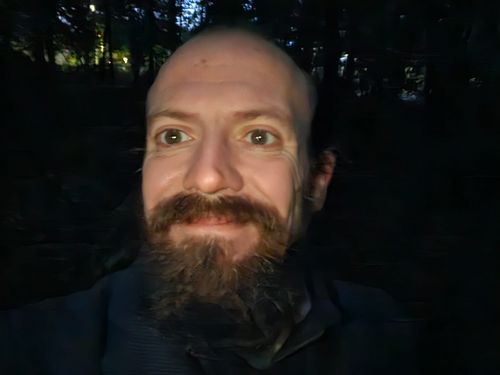
A bearded man in the dark taking selfies. Not creepy at all.

Wish I could have had breakfast with a view of the North Sea.

Bus was nice and on time
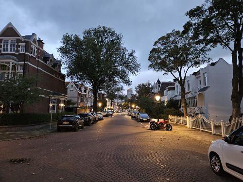
The neighbourhood around the hash was nice.

For other people, it was still early.

The sun came up and the world started living.


Achievements
In my quest to reach the Subdivision Achievement for the Dutch Provinces, this was Zuid Holland. 9/12 done!