Difference between revisions of "2000-09-09 35 -106"
From Geohashing
imported>ReletBot m (renaming category as per Naming conventions) |
imported>Benjw m (re-catting) |
||
| Line 6: | Line 6: | ||
| retro=1 | | retro=1 | ||
}} | }} | ||
| − | |||
== About == | == About == | ||
| Line 19: | Line 18: | ||
<gallery> | <gallery> | ||
Image:2000-09-09_35_-106-GPS.JPG | GPS reading | Image:2000-09-09_35_-106-GPS.JPG | GPS reading | ||
| − | Image:2008-09-08_35_-106-Couple.jpg | My wife and | + | Image:2008-09-08_35_-106-Couple.jpg | My wife and me at the location |
</gallery> | </gallery> | ||
| − | [[Category: | + | [[Category:Retro coordinates reached]] |
[[Category:Expeditions with photos]] | [[Category:Expeditions with photos]] | ||
[[Category:Wedding anniversary geohash achievement]] | [[Category:Wedding anniversary geohash achievement]] | ||
| − | |||
Revision as of 08:47, 19 May 2009
| Sat 9 Sep 2000 in 35,-106: 35.1337054, -106.7145163 geohashing.info google osm bing/os kml crox |
About
The location for my Wedding Anniversary Achievement is an empty lot near the intersection of Unser Blvd NW and Western Trail NW.
Plan
Bishop_Wash: I learned about retro geohashes the weekend of 6 September 2008. My wedding anniversary is the ninth of September and I decided to see where the hash was for that day. Surprisingly, it was within five miles of my house. I asked my wife if she wanted to celebrate our anniversary in a nerdy way and she agreed. We set off to the spot on the day before our anniversary.
Pictures
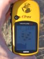
GPS reading
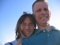
My wife and me at the location

