Difference between revisions of "2008-09-13 39 -85"
From Geohashing
imported>FippeBot m (Location) |
imported>Fippe (removing unwanted category) |
||
| Line 19: | Line 19: | ||
</gallery> | </gallery> | ||
| − | |||
[[Category:Expeditions]] | [[Category:Expeditions]] | ||
[[Category:Expeditions with photos]] | [[Category:Expeditions with photos]] | ||
[[Category:Coordinates reached]] | [[Category:Coordinates reached]] | ||
{{location|US|IN|HM}} | {{location|US|IN|HM}} | ||
Latest revision as of 16:08, 8 August 2019
| Sat 13 Sep 2008 in 39,-85: 39.9503779, -85.9611570 geohashing.info google osm bing/os kml crox |
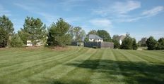
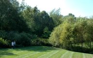
The day's coordinates fell in Indianapolis, Indiana's northeast suburbs. The precise point was located in the Hamilton Proper subdivision, at the back of a convenient lawn whose purpose was unclear.
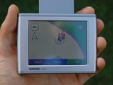
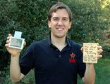
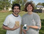
Susan, Sean, and Brett easily made it to the coordinates. They only had to walk 50 feet from the car. It was the perfect location for a meetup, so they waited for other geohashers to show up. None did, unfortunately. Brett had run out of bright pink marker flags, so they used a scrap piece of wood to mark the location instead.
