Difference between revisions of "2008-12-12 48 9"
imported>Ekorren (Been there, done that. Report will follow.) |
imported>Ekorren (→Gallery) |
||
| Line 16: | Line 16: | ||
== Gallery == | == Gallery == | ||
| − | + | <gallery perrow="4"> | |
| + | Image:2008-12-12_48_9_Blaesibadstrasse.jpg|The winter forest was really beautiful | ||
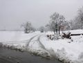
| + | Image:2008-12-12_48_9_Steinstrasse.jpg|This way? Might be passable. | ||
| + | Image:2008-12-12_48_9_Maehringen.jpg|This way? Better not. | ||
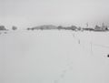
| + | Image:2008-12-12_48_9_Arbachtal.jpg|The hash must be somewhere up there in the clouds. | ||
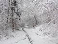
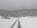
| + | Image:2008-12-12_48_9_Trail.jpg|The bike trail up, or rather: A road less travelled. | ||
| + | Image:2008-12-12_48_9_UntererLindenhof.jpg|Turn around, foolish biker! | ||
| + | Image:2008-12-12_48_9_Wuertingen1.jpg|Somewhere behind these houses | ||
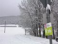
| + | Image:2008-12-12_48_9_Marker.jpg|I'm dreaming of a white hashmas. | ||
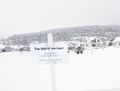
| + | Image:2008-12-12_48_9_WhiteHash.jpg|Out there. | ||
| + | Image:2008-12-12_48_9_Wuertingen2.jpg|Another view near the hash. | ||
| + | Image:2008-12-12_48_9_Bank.jpg|A soft cushion | ||
| + | Image:2008-12-12_48_9_Bike+phonebox.jpg|This is neither a sleigh nor a snowmobile. | ||
| + | Image:2008-12-12_48_9_Instruments.jpg|Coordinates, date, and as usual a totally inaccurate temperature | ||
| + | </gallery> | ||
== Achievements == | == Achievements == | ||
Revision as of 20:31, 12 December 2008
| Fri 12 Dec 2008 in Stuttgart, Germany: 48.4561421, 9.3386124 geohashing.info google osm bing/os kml crox |
About
The hash is located on a field at the edge of the village Würtingen, which is part of St. Johann community, on the Schwäbische Alb mountains, about 710 m above sea level. It is easily accessible if you go there by bus in summer. According to the skiing report for the area, which announced first class conditions for both downhill and cross country skiing, it wasn't exactly summer at the day of the hash, though.
Expedition: Ekorren
tbd
Gallery
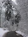
The winter forest was really beautiful
This way? Might be passable.
This way? Better not.
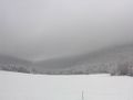
The hash must be somewhere up there in the clouds.
The bike trail up, or rather: A road less travelled.
Turn around, foolish biker!
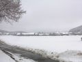
Somewhere behind these houses
I'm dreaming of a white hashmas.
Out there.
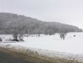
Another view near the hash.
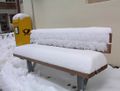
A soft cushion
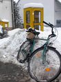
This is neither a sleigh nor a snowmobile.
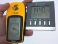
Coordinates, date, and as usual a totally inaccurate temperature


Achievements
MNIMB (may be debatable)